Rawnsley Park

|
Dogs are not allowed into most of South Australia's national parks (whether this law is justifiable is not a question I will go into here), Rawnsley is outside of the Flinders Ranges National Park and the caravan park does welcome campers with dogs; also they have two cabins in which they allow dogs. We stayed in one of these. Photo 2019/06/13, 07:19 |
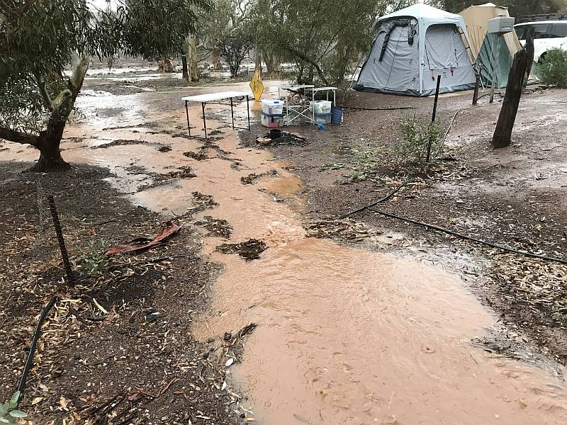
Rain, 2019/06/12
This photo was taken where a gutter ran through the camping ground. Photo 2019/06/12, 08:46
|
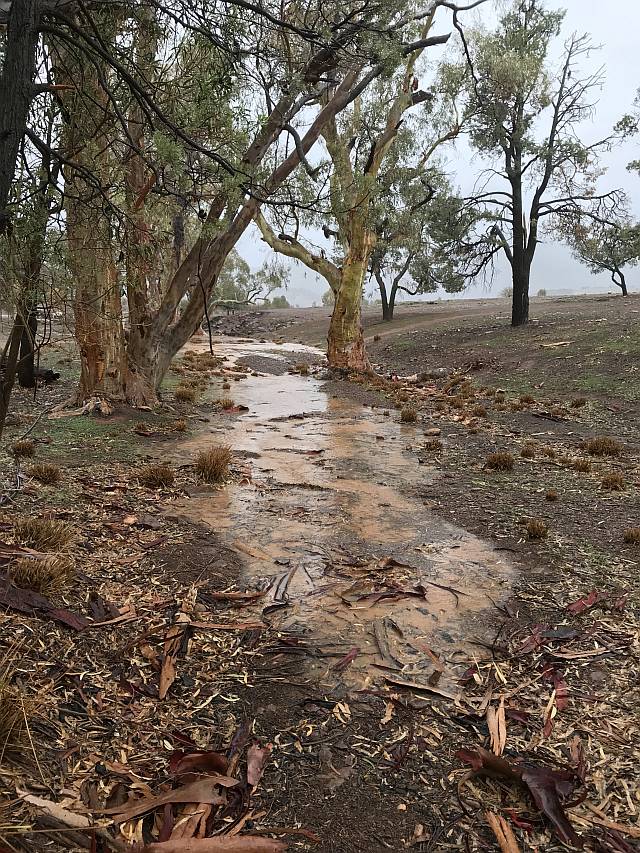
We were able to watch its progress because it was only about 30 metres in front of our cabin. Photo 2019/06/12, 08:57
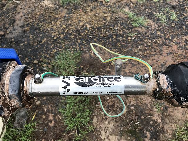
Water conditioner
I worked for 30 years in the hydrogeology (underground water) field. I came across these gadgets during that time. This and similar gadgets claim to use electric currents or magnetic fields to 'improve' the water by 'conditioning' it. It should not be confused with ion-exchange water conditioners, which replace calcium and magnesium ions (which 'harden' water) with sodium ions, improving the water for several purposes. In contrast, water conditioners take nothing from the water. There are similar devices under other names. I find it difficult to imagine how these devices could improve water in any way for gardening or agricultural uses. It is just conceivable, however, that they might somehow temporarily reduce the scaling tendencies of hard water, perhaps by changing the aggregating properties of crystallisation nuclei.
I would strongly advise anyone intending to spend significant money on these devices to insist on being shown an independent assessment done by a reputable and scientific organisation. Don't be taken in by the pseudo-scientific guff that the proponents provide on their Web sites.
What needs to be done?My impression is that there is a shortage of information available to the general public. More needs to be done by governments or other authorities on:
Water conditioner related pages...ExternalWikipedia; Quoting the introductory sentence: "Magnetic water treatment (also known as anti-scale magnetic treatment or AMT) is a method of supposedly reducing the effects of hard water by passing it through a magnetic field as a non-chemical alternative to water softening. Magnetic water treatment is regarded as unproven and unscientific." The Wikipedia article has a number of references that might prove useful.Scientific Investigations on the Claims of the Magnetic Water Conditioners, by Ashraf Kotb and A.M. Abd El Aziz, Department of Mechanical Power Engineering, Faculty of Engineering, Ain Shams University, Cairo, Egypt. A quote: "After a lot of serious laboratory measurements and chemical analysis, it is concluded that; the magnetic water conditioners have no effect on the water pH, total dissolved salts, and hardness." Experimental Performance of 'Miracle' Water Conditioners, written by Rolf Eliassen, Rolf T. Skrinde, and William B. Davis. Paper presented 1958/04/24, Journal of American Water Works Association. A quote: "Despite the frequent charges of quackery raised against them, the anti-scaling water conditioners are big business. One of the current best sellers costs from 50 to 3,000 dollars, depending on size. The manufacturer claims to have sold 100,000."
Magnetic amelioration of scale formation, by John S. Baker and Simon J. Judd; published in Elsevier Science Direct Water Research, February 1996. Suggests that magnetic treatment may have some effect in reducing scaling.
Related pages on this siteThe problem and prevalence of ignorance;
Water divining is a related superstition totally lacking in evidentiary support.
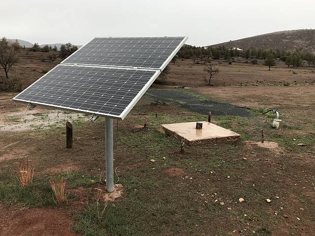
Windmill gone, solar pump takes overA view of the well-head; the 'water conditioner' is between the galvanised bend and black polythene pipe on the far right.The old windmills that used to be almost a ubiquitous feature of the Australian bush are gradually being replaced by solar powered pumps such as has been installed here. Both, of course, use unlimited, free, clean, renewable energy. An old abandoned well that was fitted with a windmill can be seen just right of centre, the bases of the windmill legs are still in place. The new well, cased with white PVC, with the 'water conditioner' in the pipeline, is on the right. Power from the solar panels goes to a submersible pump in the well. Photo 2019/06/12
|
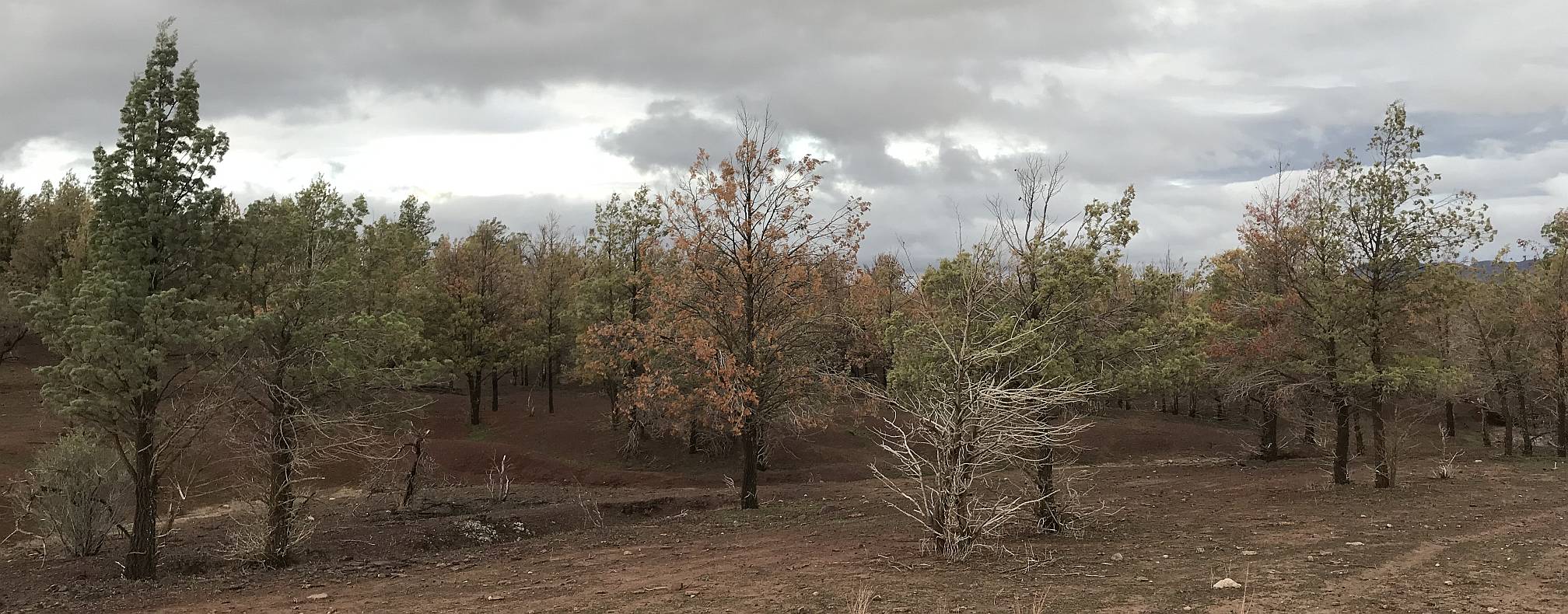
Dead trees
Photo 2019/06/12 |
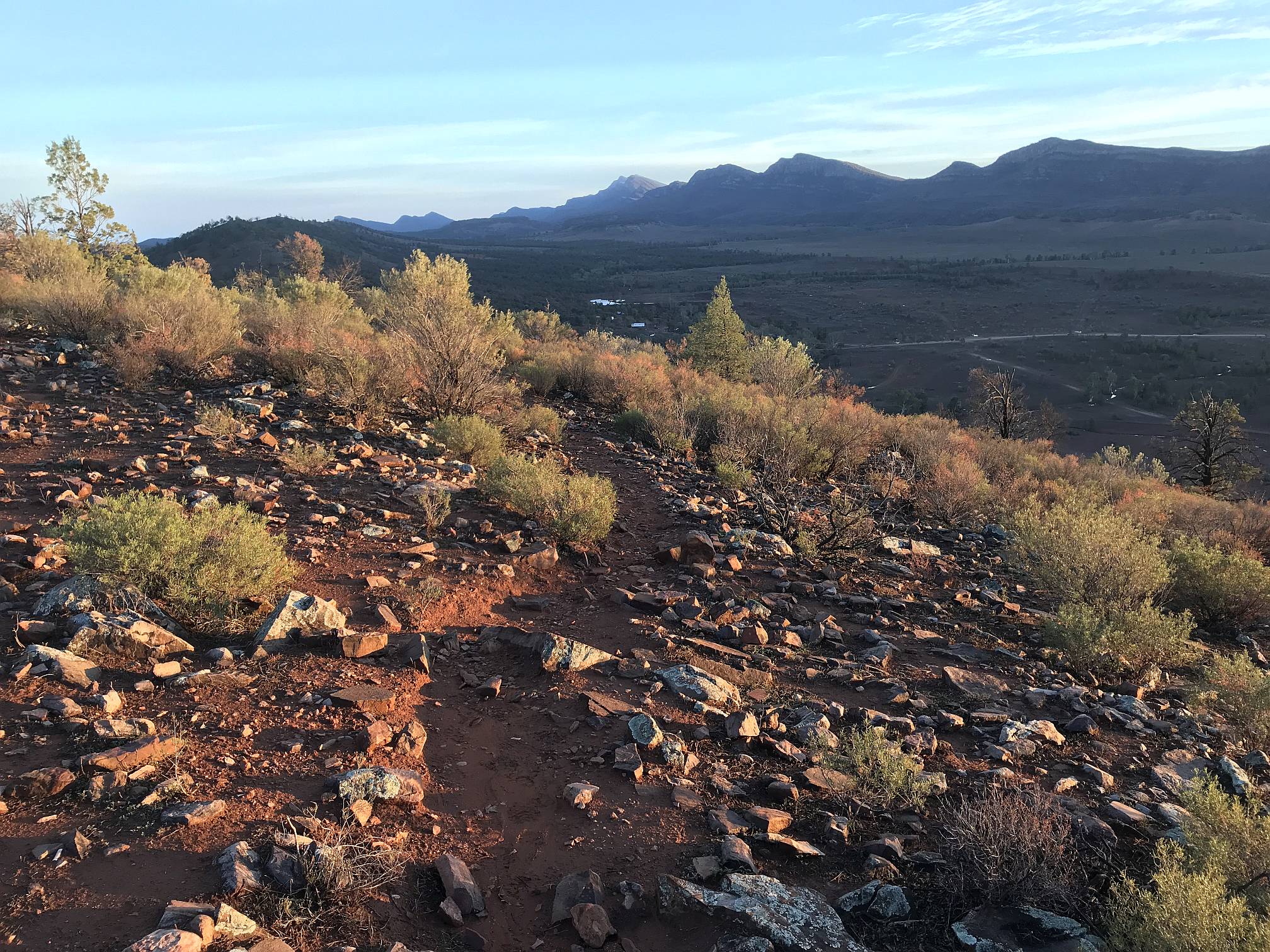
Early morning walk

|
|
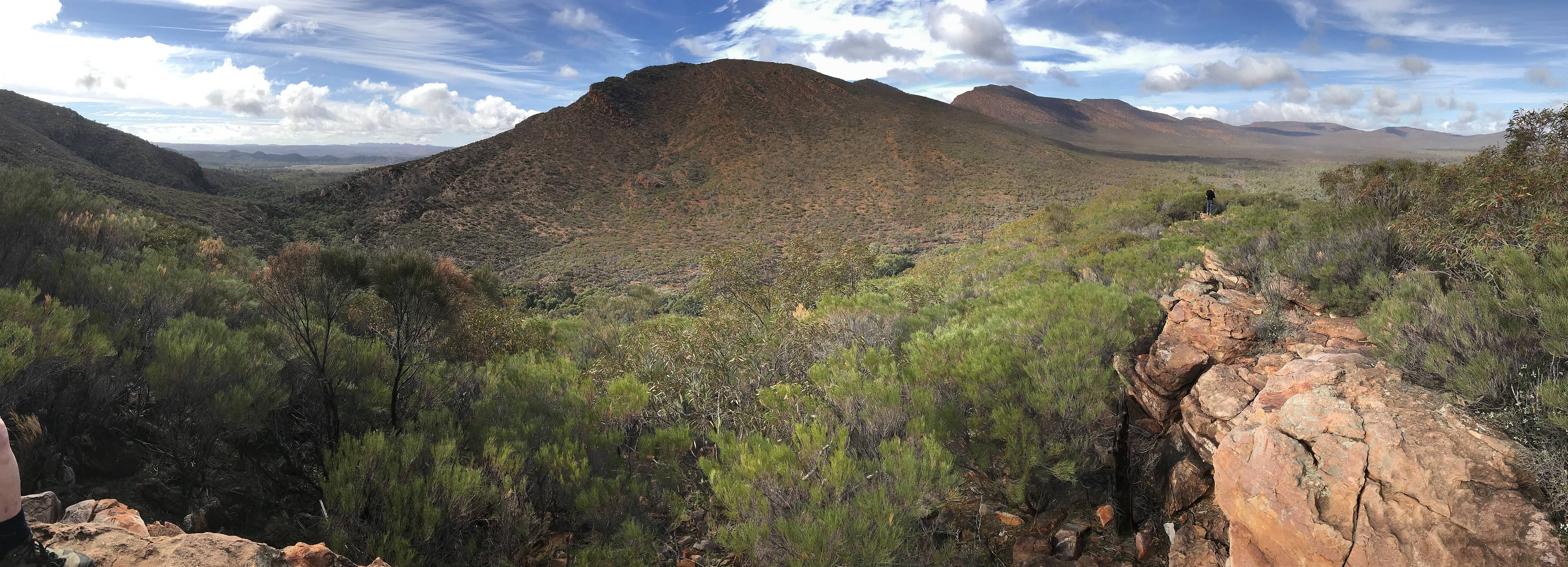
On the morning following the exceptional rain of the 12th I went for a walk before sunrise up one of the marked trails in the Ulowdna Range.
The beautiful ground-hugging fog toward the south was a bonus that I didn't expect and is probably quite unusual in the Flinders Ranges.
Notice the fog flowing over the top of some of the hills in the distance on the left (you'll need to view the high-definition version of the photo).
The fog had risen by an hour or so later. The camping ground was nearly full, but I saw no other walkers on the range; it is quite probable that I was the only person to see this. A great privilege for me! So many people miss so much be sleeping through the most beautiful part of the day. Photo 2019/06/13, 07:01 |
|
|
|
This photo was taken from around the same place as the previous one, but just after sun-rise, looking toward the east.
Photo 2019/06/13, 07:19 |
The sediments that became the rocks of the Wilpena Pound Range were laid down about 500 million years ago, but the most recent uplift that produced the landscape we see today happened a mere five million years back (see The Wilpena Group, Flinders Ranges, South Australia; Stratigraphy, Correlation, and Geological History.) The hills in the foreground and the distance on the left are parts of the Ulowdna Range.
Photo 2019/06/13, 07:26 |
Wilpena
|
|
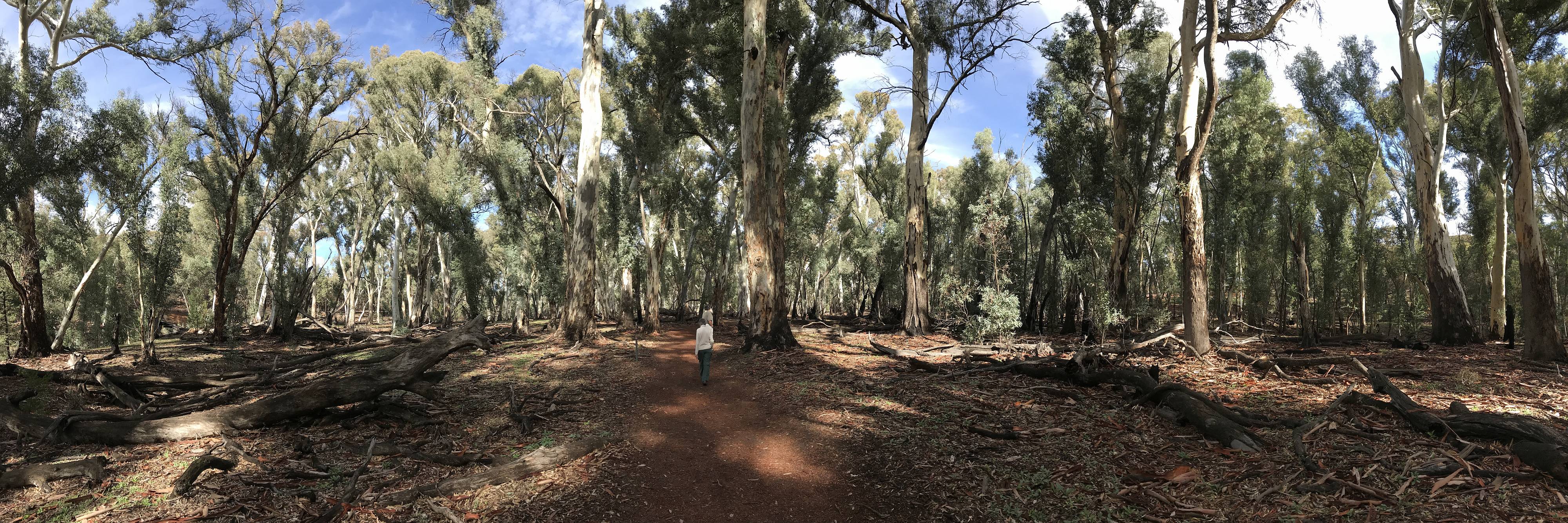
Gum trees (probably Eucalyptus camaldulensis) in Wilpena Pound, near where Wilpena Creek flows out through the gap that leads to the Wilpena resort.
Gum trees like these require a lot of water; these must get much of their water from the sediments that are 'topped up' periodically by run-off that collects in the Pound, which has higher rainfall than the surrounding area because of its altitude. The water for the Wilpena resort is groundwater that is recharged via the same source and held in the same natural storage. The main outlet for surface water from the Pound is through Wilpena Creek, and most likely the main outlet for groundwater is through sediments and fractured rocks beneath Wilpena Creek. Photo 2019/06/13 |
|
|
A panorama view of Wilpena Pound recorded from the lower of the two Wangara lookouts, which are just inside the Pound.
It is about a three kilometre walk from the car parking area into the Pound, a bus is available to take people part of the way once or twice a day. Photo 2019/06/18 |
|
|
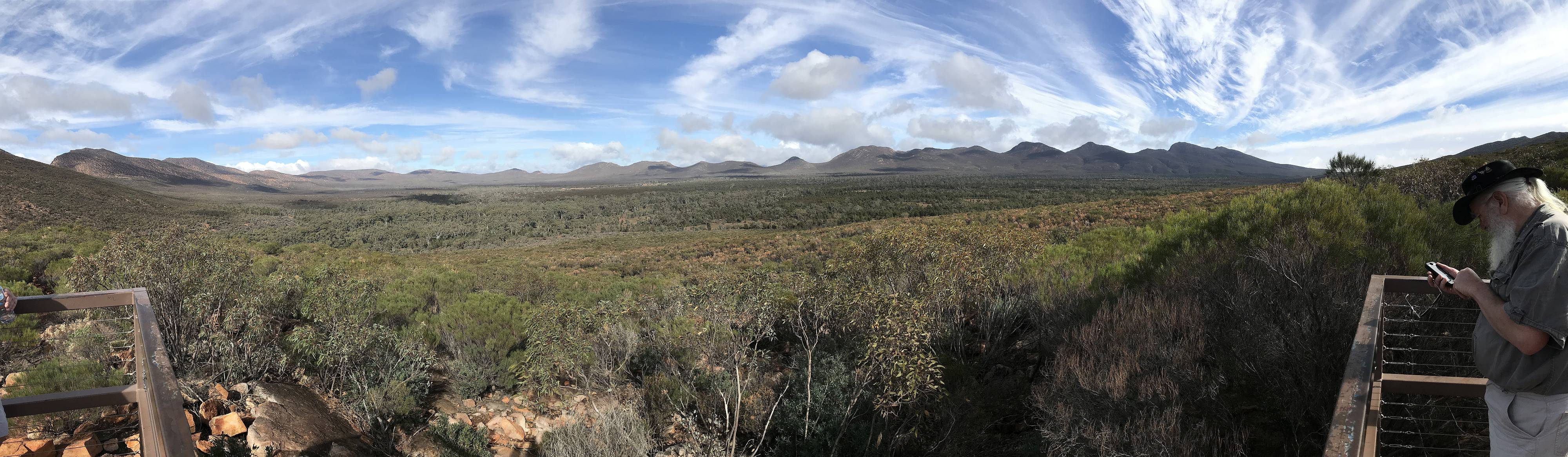
A panorama view recorded from the higher of the two Wangara lookouts.
The ABC range and the more distant Bunker Hill Range are visible in the distance through the gap (in the high-definition image). The gap, through which Wilpena Creek flows, is the main entrance into the Pound for walkers, there is no vehicle access, except for emergency use.
Photo 2019/06/13 |
Sunrise from Twidale Tops
|
|
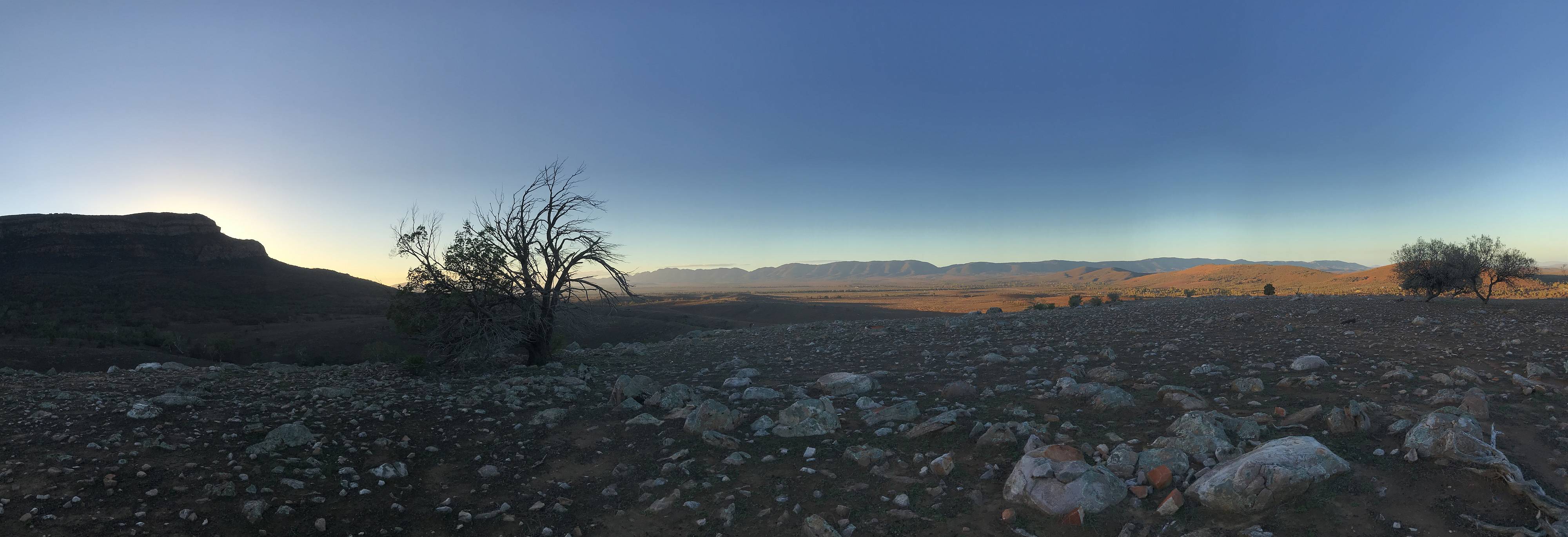
Taken during another early morning walk, on our last morning in the Flinders Ranges.
Rawnsley Bluff, a part of the Wilpena Pound Range, on the left, the Chase Range in the centre distance, the Ulowdna Range nearer on the right. Photo 2019/06/14 |
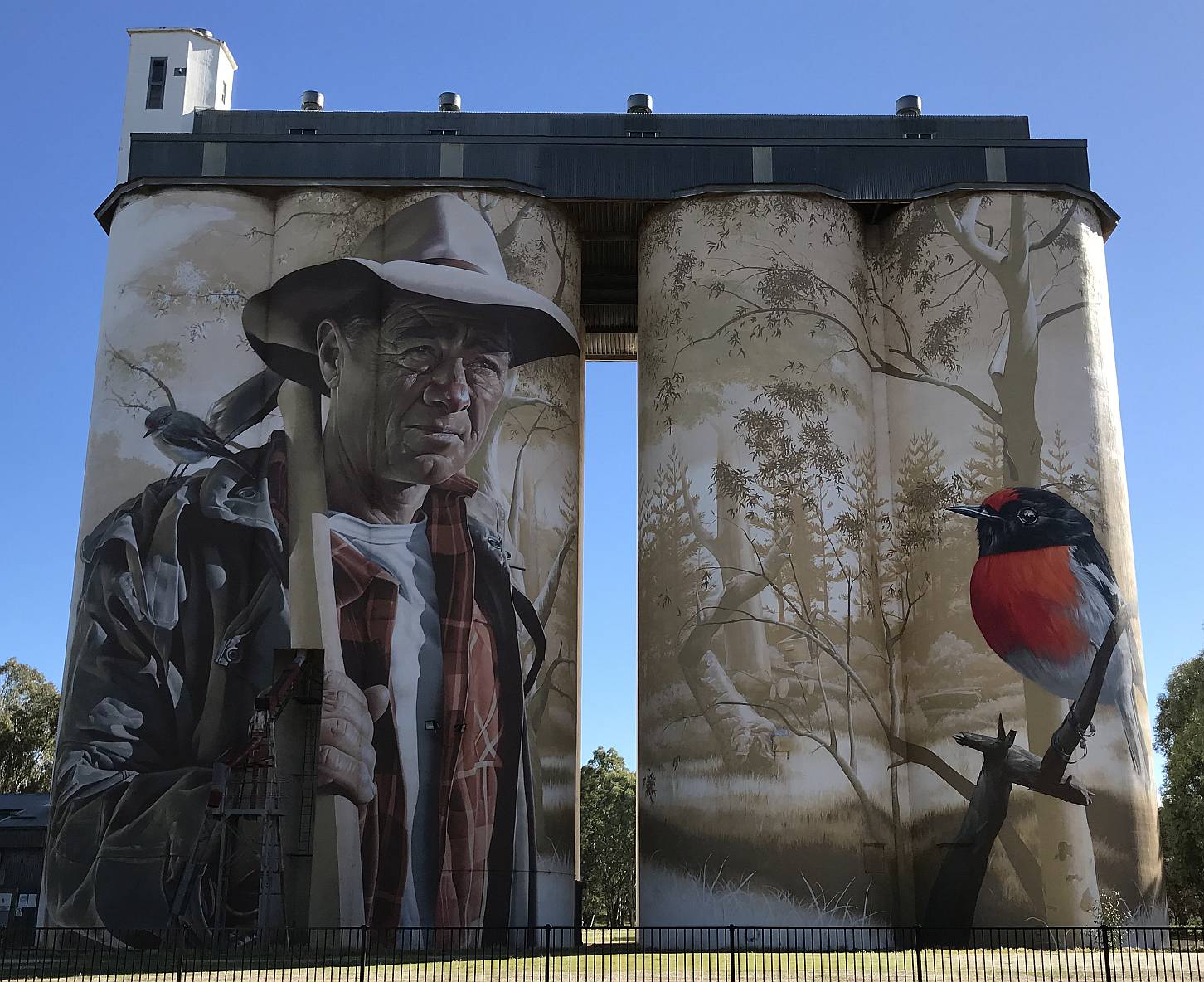
Wirrabara silo art
On another page I've recorded more silo art near Benalla and north of Horsham, both in Victoria, and Waikerie in South Australia. Photo 2019/06/14
|
|
|
Related pagesPhoto pages inside AustraliaBeetaloo Dam, 2014Clare Valley, 2007 Clare Valley, a collection of photos over the years Coober Pedy: photos and observations, 2016 Central NSW, March-April 2017 South eastern SA and Victoria 2018 Flinders Ranges, 2006 A collection of my better photos of the Flinders Ranges over the years, 2020 Kangaroo Island, 2009 'Across the Nullarbor', 2009 South eastern Australia, November 2016 Victoria, Autumn 2019 Wind farms... A development opportunity, the view from the top, 2018 Canunda/Lake Bonney, 2006 Hallett, 2008 Mount Millar, 2006 Snowtown, 2008 Starfish Hill, 2007 Turbine images with messages, 2014 Victoria, 2008 Wattle Point, 2007 Photo pages outside of AustraliaIndia; visit 1989; modified 2009Indonesia; visit 1994; modified 2009 Japan, 2017 Vietnam, visits 2004-08; modified 2017 Cambodia, Laos, Vietnam, 2011 Singapore and Malaysia, 2015 |
|
|