Peel Estuary and Mandurah - Observations

After periodically visiting our daughter who had lived in Mandurah for nearly 20 years my wife and I moved to Erskine, a Mandurah suburb, in February 2022.

The Peel estuary and the Mandurah area in general is very attractive and popular for visitors and as a place to live. This, of course, leads to challenges in maintaining the environment.

Having a naturally inquiring mind I needed to learn about the local environment. This page sets out some observations, thoughts and provisional conclusions that I have drawn from what I've been able to learn about the area.

As I've noted elsewhere on these pages, there seems little effort made by people to maintain the parks and gardens in their community. The Mandurah area is no different. I've written a page on my efforts to control weeds in and adjacent to the beautiful parks in my area.

Unfortunately the authorities responsible for looking after the area have been sometimes found lacking, inconsistent and even worked against the preservation of the natural environment especially in the excessive and unnecessary widening of paths through the Len Howard Conservation Park. They have done little to control weeds such as the very invasive fleabane and false onion weed.

This page was started 2022/05/02, last edited 2024/02/27
Contact: David K. Clarke – ©


This is a work
in progress


The Peel-Harvey Estuary

Tidal Movement

I was unable to find any very useful reference on the Internet about the amount of tidal movement that was typical in the Peel estuary so I decided to take my own measurements at a time of Spring Tides, the new Moon of 2022/04/30.

Six readings taken over a period of 22 hours at a period of Spring tides (new Moon, 2022/04/30-05/01) indicated a total range of about 20cm. This seems to be about a third of the tides on the coast.

(Tide levels are available on the Internet for 'Mandurah' but where these levels apply to is not given. If they are in the estuary then they are probably substantially less than on the coast.)


This section added
2022/08/11

Water colour change

 
The water in the Peel estuary is usually colourless, sometimes clear, sometimes - if there has been a lot of wind and sediment has been stirred up - cloudy.

On this day we noticed it was clear but strongly coloured brown, probably from tannins that had washed in with the high flows in the Murray and Serpentine Rivers that feed into the estuary.

I also noticed that the water tasted fairly fresh. It is normally about the same as sea water in salinity. It seems unlikely that the salt water in the whole 60 square kilometres of the Peel lagoon could have been replaced with fresh, so more likely that the fresh water had for some reason come over this side.

The data I had from Dr Steve Fisher, Operations Manager, Science and Waterways, Peel-Harvey Catchment Council, showed some very low salinity readings had been collected in the past, so it was quite possible that this water was almost fresh.

Photo iPhone 11 Pro, wide angle lens, 1.54mm, 2022/08/11


Two colours in the water
This panorama, which covered about 120 degrees, shows that the water in the Mandurah Quay harbour (on the left) was coloured by the tannins, while the water in the more open estuary (on the right) was colourless.

The water in the harbour was not so strongly coloured as the water that I recorded above, on the previous day. I tasted the water on both sides of this photo. Both were somewhat saline, I couldn't be sure if there was any difference in the salinity between them.

Photo iPhone 11 Pro, 2022/08/12


This section added
2022/05/03

Dead trees in the Peel estuary

Dead trees, egrets and spoonbills
A very few of the thousands of dead trees in the Len Howard Conservation Park (there can be little doubt that the deaths are due to climate change). I think that these particular ones are in what I have called the Spoonbill Rookery near Mandurah Quay.

Anyone walking on the Len Howard Trail (through Len Howard Conservation Park) can't help noticing the number of dead trees in and near the small swamps and lagoons. It seems that the swamps were all once host to healthy Melaleuca trees, but they can no longer support them.

The most obvious possible cause for this would be an increase in the salinity where the trees are. It is not easy to find out if this is definitely the cause.

On another page I have noted tree deaths in Black Swan Lake, Lakelands, in the period from 2018 to 2024.


A summary

The text in this section can be summarised as: It seems most likely that the tree deaths are due to increased salinity in the estuary and that the increased salinity is due to decreased runoff which itself is due to climate change.

Salinity record

On 2022/04/13 Dr Steve Fisher, Operations Manager, Science and Waterways, Peel-Harvey Catchment Council - Provided me with data from “the Marine and Freshwater Research Laboratories (MAFRL)  from five  sites in the estuary between the 1970s and mid 2001.

From these data I found that the average of all the top salinity recordings at site #2 (near Dawesville and Falcon) from 1977 to 1994/04 (when the Dawesville Channel was constructed) was 25 parts per thousand (ppt), bottom salinity 27. After that time, up to mid 2001 when the data series ended, the averages were 32 and 35 respectively. From that, for what it is worth, the top salinity (having the greatest relevance for the trees) has increased by 28% since the construction of the Dawesville cut.

 
More dead trees
Dead trees
Dead trees adjacent to the Len Howard Trail. Far more can be photographed by a drone.
The fine-stemmed creeper on the left is, I believe, one of the obligately parasitic Cassytha species (that in SA, but apparently not in WA, is called snottygobble).
The tree on the right is commonly called a paperbark, probably either Melaleuca cuticularis, salt water paperbark, or Melaleuca rhaphiophylla, swamp paperbark. Most of the dead trees are probably of the same species.
Photo iPhone 11 Pro, 2022/05/05
From the above it does seem that the average salinity in the estuarine system has increased. My impression, again, for what it is worth, is that the increased salinity is likely more to do with decreased rainfalls since the 1970s (itself due to climate change) than due to the construction of the Dawesville Channel.

Quoting from a Water Corporation publication, Climate change and WA - Climate and Southern WA:

“A 20% drop in rainfall may not sound very dramatic until you understand the impact it has on streamflow – the water that runs off into our dams and other storages. The decline in rainfall throughout Perth and the South West has seen streamflow reduce by an average of over 80%!”

It seems that rainfall and runoff is likely to continue to decline into the future. Quoting Climate projections for Western Australia; Rainfall projections published by WA department for Primary Industries and Regional Development:

“The drying trend in the south-west will continue as greenhouse gas concentrations increase according to the modelling. The projected changes differ a little from the observed changes in recent years. There may be an increase in synoptic systems bringing helpful rainfall to the northern and eastern grainbelt and south coast, but the projected drop in the number of deep low-pressure systems means much less rainfall for the west-coastal regions and far south-west. The overall increase in atmospheric pressure over southern WA will likely drive a shift to a more settled weather regime, with more highs persisting for longer.”
The reference was marked "Page last updated: Thursday, 15 April 2021."

Seasonality of rainfall

Just by the way, I have noticed that the annual rainfall in Mandurah is much more concentrated in the cooler half of the year, especially May to August than it was back in Clare, SA, where I used to live. In Mandurah 2/3 of the annual average rainfall occurs in the 1/3 of the year from May to August, 3/4 of the annual average rainfall occurs in the five months from May to September.

Average rainfalls for Mandurah (from BoM)

Jan
Feb
March
April
May
June
July
Aug
Sep
Oct
Nov
Dec
Total
Mean rainfall
14.5
12.0
15.8
39.9
83.2
117.7
115.5
93.2
58.7
31.2
22.8
13.9
603.9

A very dry period

In late 2023 and 2024 the recorded rainfalls for Mandurah were:

Dec 2023
Jan 2024
Feb
March
April
Total
Recorded rainfall
0.6
0.0
1.8
1.2
0.8
4.4

I believe that this was a record low rainfall for the beginning of the year.

The very dry period came to a sudden end on 2024/05/02 when we had 30mm, mostly in a very heavy downpour at around 3pm.


This section added
2022/08/11

Len Howard Conservation Park

Weeds in and near the LHCP

 
I've written on another page about the infestations of invasive weeds into the Len Howard CP and nearby area and on my efforts to control several of the most conspicuous and invasive offenders.

The patch of fleabane in the image on the right was in the southern part of the big seasonal paperbark reserve. Note that it is on a slight mound; I suspect that the surrounding area is seasonally flooded and that this kills any fleabane seeds in the soil.

I sprayed this patch on 2023/01/05

Photo iPhone 11 pro, 4.25mm focal length standard lens, 2023/01/05


Lightning blasted and charred tree

 
Lightning blasted tree
The photo on the right is of a lightning blasted Casuarina tree beside the concrete shared-use path adjacent to the Len Howard Conservation Park - on Glendart Court.

Perhaps surprisingly this was not the tallest tree in the area, but it wasn't far off. I wonder why it was hit rather than another tree? Perhaps it was a better electrical conductor?

The splitting of the bigger trunks and the charring of the top part of the tree are shown in more detail in the following photos.

These photos were taken using a Cannon Ixus 190 on 2022/08/11 a few days after the lightning strike.

Most of the tree was killed by the lightning strike, but a small section was still alive at the end of 2022. It had entirely died by early February.

 
Lightning blasted tree trunks

Note that the largest trunks, on the right and left, have been split. I believe this is caused by the moisture in the tree flashing to steam due to the heating effect of the high electric current.

 
Lightning blasted tree top
The top part of the lightning blasted tree.

To see the top part of the tree and the charring in more detail click on the image.


This section added
2023/06/11

Unnecessary and destructive widening of the paths in the Len Howard Conservation Park

 
An appropriate width for a path in the LHCP
Narrow path with puddle
Photo iPhone 11 Pro, standard lens (6.25mm), 2023/06/08
Over a few days in early June 2023 the two paths running east from the car park to several hundred metres past the boardwalks were widened and sheeted, impacting on the adjacent native vegetation.

They were quite wide enough before this. Where work was warranted was to the NE of the boardwalks where water puddles form in the low points of the path.

Widening of the paths would have been justified if this was a recreation park, but it is supposed to be a CONSERVATION park! Surely conservations parks should be more about conserving nature than destroying it!

The section of path in the photo is further east than the widened section. In wet weather there are many puddles such as the one here. The low points where puddles form could be filled by a couple of people with loam and wheelbarrows in a day, but I suspect that machinery is (over)used partly at least because it is less physically demanding.

 
A section of the widened path
Widened path
Photo iPhone 11 Pro, standard lens (6.25mm), 2023/06/11
The Parks and Wildlife Service, which is responsible for this park and presumably ordered the work, state that they "protect and conserve the state's natural environment". Yet here they are unnecessarily destroying a part of the natural environment. The Parks and Wildlife Service is a part of the Department of Biodiversity, Conservation and Attractions.

I suspect that Len Howard, if he was still alive, would be disgusted with this operation.

At the time of writing it remains to be seen how effective the widened paths will be, especially since they were graded flat, with no crowning in the centre to run the water off to the sides. No culverts were installed to run water under the paths where necessary.

The improvement of the surface of the path is welcome, but the 'improved' part is twice as wide as it needs to be.

I have written about a similar widening of a different part of the LHCP paths under A backward step on another page on this site.

 
Boulder placed to stop vehicles
Path with boulder
Photo iPhone 11 Pro, standard lens, 4.25mm, 2023/06/15
As the path was it was too narrow for vehicles. When widened the path became wide enough to tempt irresponsible people to drive illegally through the Len Howard Conservation Park, so this boulder needed to be put in place.

One wonders, how long will it be before someone drives around the boulder?

I have spent many hours in removing invasive weeds and rubbish from the Len Howard Conservation Park and its vicinity (see another page on this site). This vandalism of the park, by the organisation that should be protecting in, is very disappointing.

A section of the path that needs attention

 
Pond and bog in the trail
Pond on trail
Photo iPhone 11 Pro, standard lens, 4.25mm, 2023/08/17
This part of the trail desperately needs attention from The Parks and Wildlife Service. It seems to be getting worse each winter. A small fraction of the amount of money that was spent on the unneeded path widening discussed above would have fixed this mess.

It is in the LHCP adjacent to the Bridgewater Lifestyle Village.

It is almost impossible to get passed dry shod. There are one or two other ponds in the path nearby, but this one is by far the worst.

I contacted the Parks and Wildlife Service about this problem on 2023/08/17.

Another page on this site discusses why so many people (including myself) are inclined to just walk by something that is not as good as it should be instead of doing something about it.


This section added
2022/07/26

The big seasonal paperbark swamp (BSPS) in the Len Howard Conservation Park

Big seasonally paperbark swamp
Photo iPhone 11 Pro, focal length 6mm (telephoto), 2022/07/24.


How the swamp came to be a reserve

On 2022/08/08 I was told by an employee of the City of Mandurah that a condition of the development of the Bridgewater Lifestyle Village was that the swamp area had to be kept in its natural state as a reserve. Both areas were owned by the same people,
 

Responsibility for the BSPS

The parts of the reserve outside of the paved paths are Council responsibility, the inner part is the responsibility of the Parks and Wildlife service.
 

Weeds

I did not immediately realise how badly the BSPS reserve was infested with weeds, particularly fleabane and false onion weed. Some of Mandurah's parks are very well looked after, others are relatively neglected. I have made a project of removing these weed species to the best of my ability.
This swamp, which doesn't seem to have a name (but should have) is either a part of the Len Howard CP or is at least adjacent to it (I've not seen a definitive map of the park). I have previously called it the 'big ephemeral paperbark swamp' but considering that it contains a significant amount of water for several months from winter onward it seems that 'seasonal' is more appropriate than 'ephemeral'.

In 2022 Erskine had a wet winter, by my records there had been 129mm of rain in May, 148mm in each of June and July and about 70mm in the first third of August. Consequently by this time the swamp was full and overflowing into the main estuary pool. I've written elsewhere on these pages, with photos, on the swamp through the seasons.

When was the big seasonal paperbark swamp (BSPS) empty, full, overflowing in 2022?

I don't seem to have recorded when the swamp started overflowing, it was probably at least a couple of weeks before I took the photo above, that is, early July. Surface flow from the swamp into the estuary stopped on 2022/09/28.)

Observations on water in the BSPS, 2023

The first part of the year was drier than normal, I recorded only 103mm up to the end of May, the BoM average to May is 170mm (2/3 of the annual rainfall usually falls in the four months from May to August and 3/4 in the five months from May to September).

There are only two small water courses, that I have called gutters for want of a better name, leading into the BSPS. Both on the eastern side.

2023/06/06:11:30, water has just started flowing into the swamp through the northern of the two gutters. By my records there had been 41mm of rain in the previous week.

 
Filling without surface flow, 2023/06/17
Water in swamp
This photo was taken on 2023/06/17. There had been very little rain to the beginning of June. In June there had been about 140mm, but there had been negligible surface flow into the swamp.
Photo iPhone 11 Pro, standard lens
2023/06/10:17:30, a trickle only in the northern most of the two gutters into the BSPS. The southern one was still dry. By my records there had been 103mm of rain in the previous two weeks.

In the two and a half weeks to 2023/06/17 there had been about 140mm of rain but negligible surface flow into the swamp. Yet, as shown in the photo, there was a large pond in the centre of the swamp.

2023/06/21, 172mm of rain in June so far, 24mm in last 24 hours; a trickle in the northern gutter, southern one dry.

There was a total of 177mm of rain in June, 115mm in July. The swamp started overflowing on 2023/08/15 following 70mm of rain to that date in August, 27mm of that in the previous 24 hours. At the time there was not much more than a trickle in the northern of the two drains; it seems that most of the water in the swamp either comes directly from rain or from groundwater. The swamp stopped overflowing within a few days one side or the other of 2023/09/08.


This section added
2024/01/03

Observation on lack of undergrowth in the Big Seasonal Paperbark Swamp (BSPS)

In the portion of the Len Howard Conservation Park that runs along the Peel lagoon the undergrowth, where it has not been cleared for paths, is so dense that it is very difficult to walk through. However, shrubby undergrowth is almost entirely absent from the BSPS.

Local shrub species probably can't grow in the section of the swamp that is seasonally flooded (the flooded section of Marlee Reserve is similarly free of shrubby undergrowth).

However, the lack of shrubby undergrowth in the other parts of the BSPS seems to me likely to have been due to heavy grazing before it became a reserve.


Strange white algae in Len Howard Conservation Park

 
White algae
This striking and strange fibrous material, that appeared to be a dried up algae, was left behind when the saline water from what was a shallow seasonal swamp within the LHCP dried away.

The most likely cause for the death of the trees in this area, as discussed elsewhere on this page, is climate change resulting in increased salinities in the lagoons, but it is not a simple situation.

I've also noted the impact of climate change in the Clare Valley of South Australia.

Photo iPhone 11 Pro, wide angle lens, 1.54mm focal length, 2023/10/31


Close-up of white algae
A close up of the white ? algae. The key is there for scale.

Click on, or touch the image to see higher magnification. The fibres look quite glassy when magnified.

The width of the field of this image is about 11cm. The width of the magnified image field is about 7cm.

Photo Canon Ixus 190, 2023/11/02


The ocean beach at Mandurah

 
Seaweed
I've placed photos of some of the ocean beaches on another page on this site, but this particular photo deserves a spot on this page of observations.

Seaweeds are classified into green, brown and red types. It looks like all three could be in this tidal zone pool.

Cottesloe Coastcare Association, a Perth group, has a page on seaweeds.

Photo iPhone 11 Pro, standard lens, 4.25mm fl, 2023/11/03


Wildlife

Bandicoots

 
Southern brown bandicoot
Bandicoot
Southern brown bandicoot (Isoodon obesulus, another common name for it is Quenda)
Photo Canon Ixus 190, 2022/02/28
There are bandicoots in the more densely scrubby areas along the lagoons of Mandurah. This one was near the Serpentine River in Greenfields.

It was sitting quietly beside a path and a man was already sitting on the path when I arrived. I wonder if he had attracted the bandicoot by feeding it?

I have since seen several more bandicoots in the Novara Beach Reserve. They seem most likely to be seen at dusk, dawn or night time. Generally, but not always, they are inclined to run into cover quickly after seeing a human.


Kangaroos

Kangaroos at a feeding station that someone maintains adjacent to the Len Howard CP
Kangaroos
Photo taken 2022/03/16, Canon Ixus 190

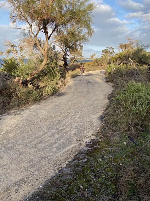
The kangaroos that live in the Len Howard CP are very relaxed around people. Many times we have seen them grazing on someone's front lawn. I've seen one hop through a front gate to do some grazing in mid morning.

In the period at least from February 2022 to the end of 2022 there was a mob of 25 or more kangaroos resident in the BSPS. If anything these kangaroos are even more relaxed around people than those that use the feeding station mentioned above. The most relaxed one of them all is possibly the injured kangaroo mentioned elsewhere on this page.

 
Injured kangaroo
Photo 2022/05/25
 
Injured kangaroo
Photo 2022/08/13

Added comment

Early this morning (2022/05/05), when there was hardly any daylight, I was walking through the little reserve at the western intersection of Silverton Crescent and Wattleglen Avenue on my way to do a fortnightly plasma donation when I saw a kangaroo in front of me. It casually did a couple of hops in the direction I was walking a couple of times then stopped, stood up to its full height - to intimidate me - and stood as I walked past about three metres away. At its full height it was only a little shorter than me (I am about 1.8m tall).

Injured kangaroo - two photos on the right

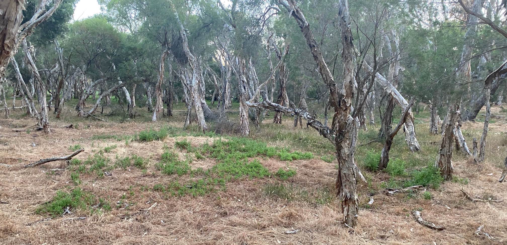
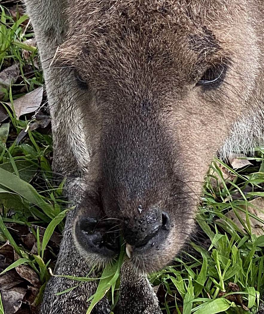
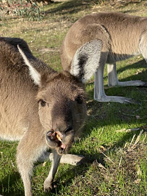
This kangaroo had a badly injured mouth, but was grazing peacefully when I photographed it. It is one of the big seasonal paperbark swamp (BSPS) mob.

Photo iPhone 11 pro, telephoto lens, focal length 6mm, 2022/05/25

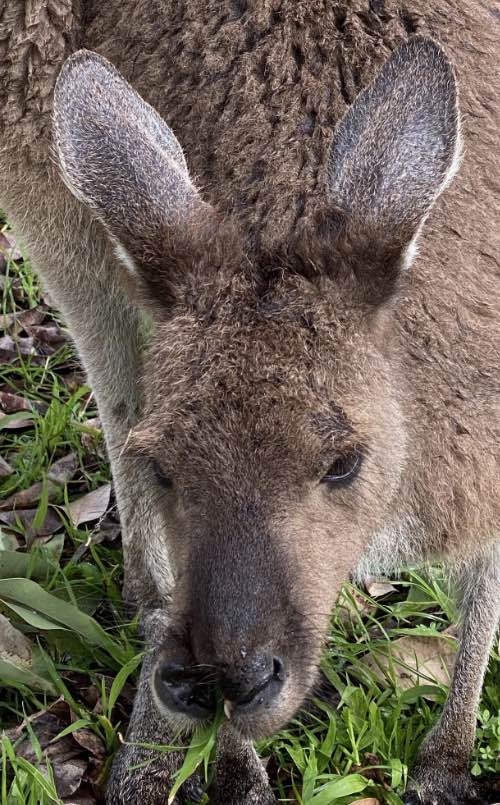
I happened across the same kangaroo again on 2022/08/13. The second photo on the right is the best I could get at the time.

It looks like the injury has healed quite a bit, but the kangaroo's mouth is never likely to return to anything like its original form.

Click for a more detailed image of the mouth area. Use back-arrow to return.

Photo iPhone 11 Pro, telephoto lens, focal length 6mm.

Updates

I came across this kangaroo again on 15th August and 25th September 2022, 2nd of January and 2nd of February 2023. In January she was obviously carrying a large joey in her pouch, so she has done very well; in February the joey was following her around. The injury was still conspicuous, but not so much as it was in the earlier sightings. Oddly she seems tamer than most of the swamp mob, I wonder why. On the February sighting there was a young joey near her.

I happened to see her again on 2023/05/12. I could not get a good photo, but I think her mouth looked much the same as it did in 2022/08/13. She did not have a joey following her.

I happened across her again on 2023/08/11. She obviously had a fairly large joey in her pouch - the second one I've seen her produce. Again, her mouth looked much the same as it did in 2022/08/13.

On 2024/02/26 I saw her again. Her second joey since the injury was still with her and about 2/3 grown. She seems to have gradually become less comfortable with me getting close to her. The first few times I saw her she was so tame that I had the impression she might have once been someone's pet.


Also see bird wildlife in my backyard on another page on this site.


This section added
2022/05/04

Lizards

 
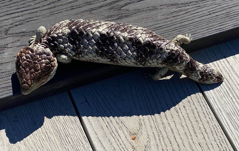
Bobtail lizard (Tiliqua rugosa rugosa)
Bobtail lizard
The lizard that I have always previously called the sleepy is generally called the bobtail in WA. The local variant is Tiliqua rugosa subspecies rugosa, the eastern variant is Tiliqua rugosa subspecies asper.

This was the first lizard that I can recall seeing in the three months that I had been in WA, and to that time I had not seen any snakes at all. It was between Dampier Avenue and the scrub adjacent to the lagoon.

Lizards of many species were common in SA, they seem less common in this area of WA.

Update 2023/02/08

I have now seen three snakes, probably dugites (Pseudonaja affinis, also called the spotted brown snake) and there are many small skinks about, between about 4cm and 10cm, although they will not usually be noticed until they move for some reason. And I've seen at least one dragon lizard, perhaps a bearded dragon.


This section added
2022/07/26

Bats


Update January 2023

I still haven't seen any bats.
While I have watched for bats on my frequent walks in the early morning and occasionally evening, I don't recall ever seeing a bat in the Mandurah area. With so many mosquitoes to provide food for microbats I would have expected bats to be quite common.

I did wonder if the frequent aerial treatment, by helicopters, to reduce mosquito numbers had wiped out the local microbat population. But I read information sheets from the City of Mandurah stating that the mosquitoes numbers are controlled with very specific larvicides (S-methoprene) and Bacillus thuringiensis israelensis.

So it seems unlikely that the mosquito treatments would account the the apparent low bat numbers. I've been told that some bat roosting boxes have been placed, so perhaps the low numbers are related to a lack of roosting sites - perhaps that may be connected to the great numbers of dead trees?


This section added
2023/08/03

Plants

Sundews

 
Sundews
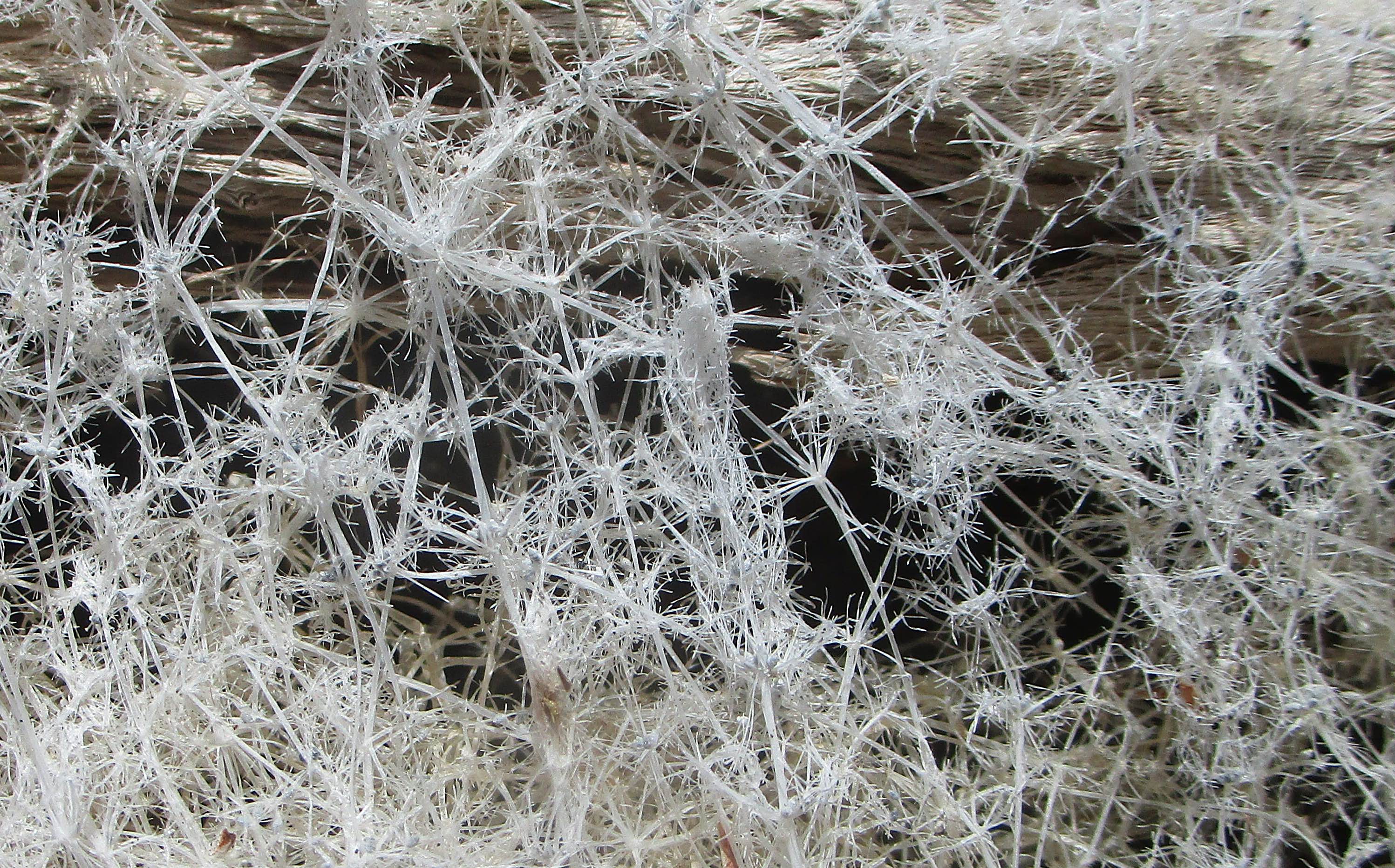
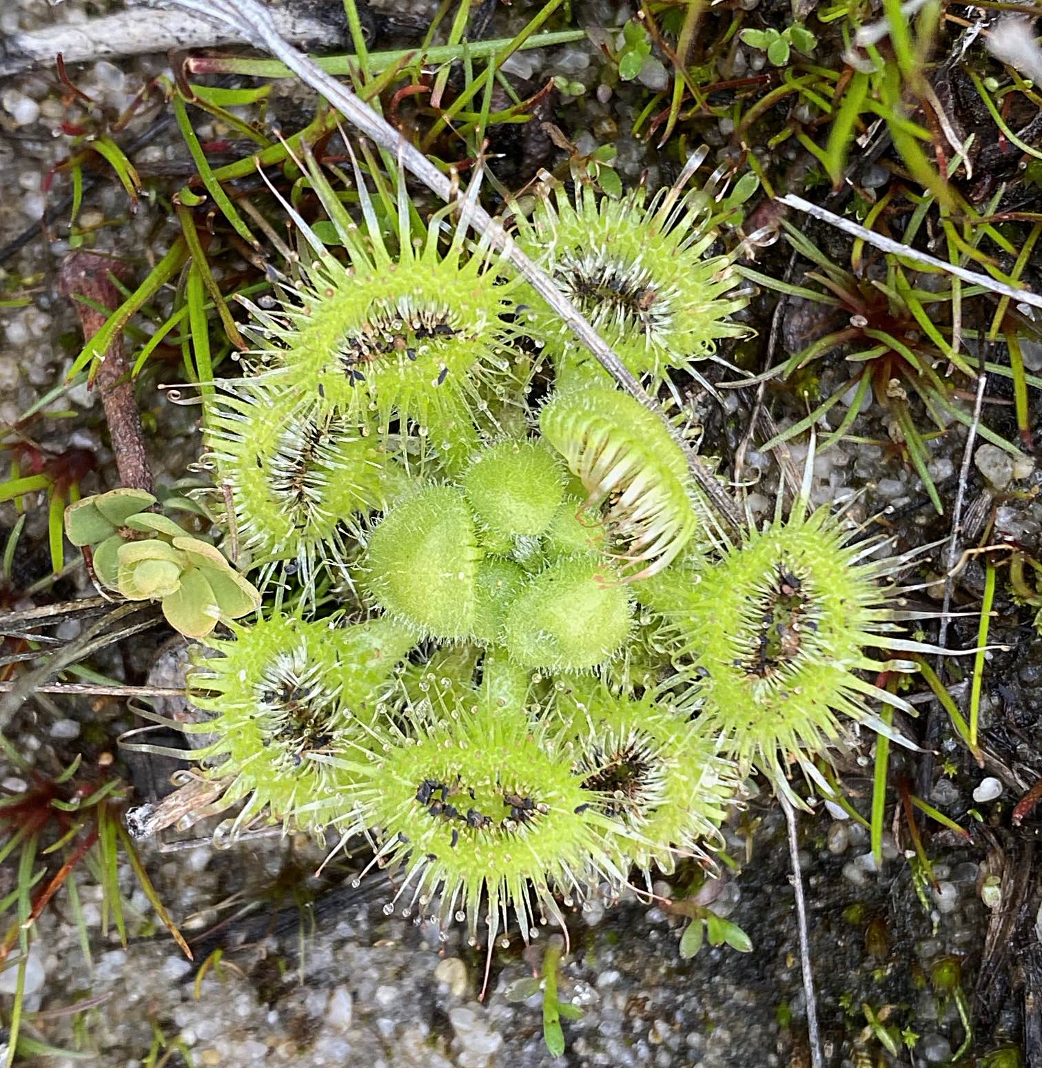
These sundews were among a number growing by the concrete path adjacent to Silverton Crescent on the edge of Len Howard Conservation Park.

They are insectivorous plants that supplement the nitrogen that is available from the soil by capturing small insects and digesting them.

Another plant on this page is the curious white algae of the LHCP.


This section updated
2023/01/03

Dog water

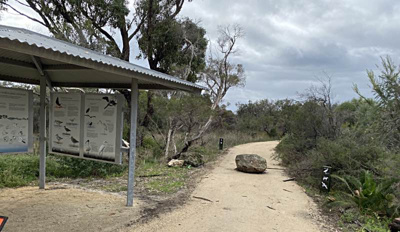
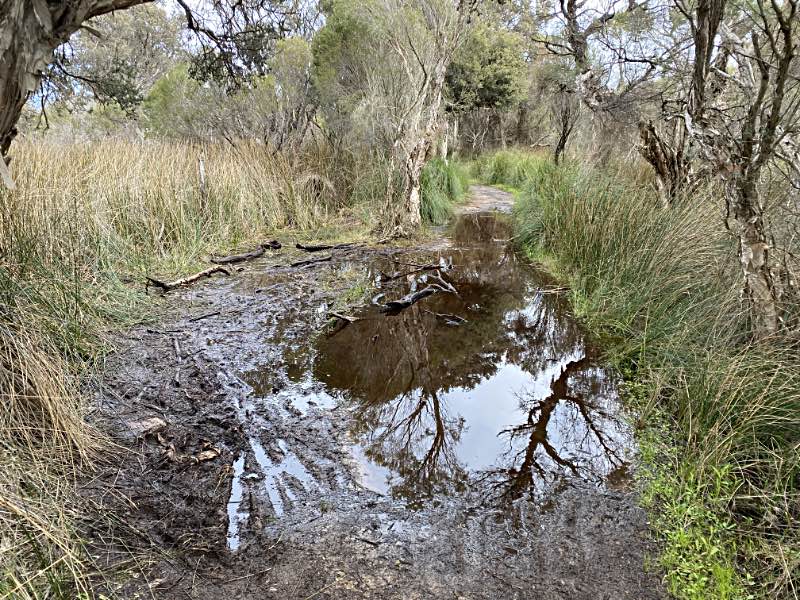
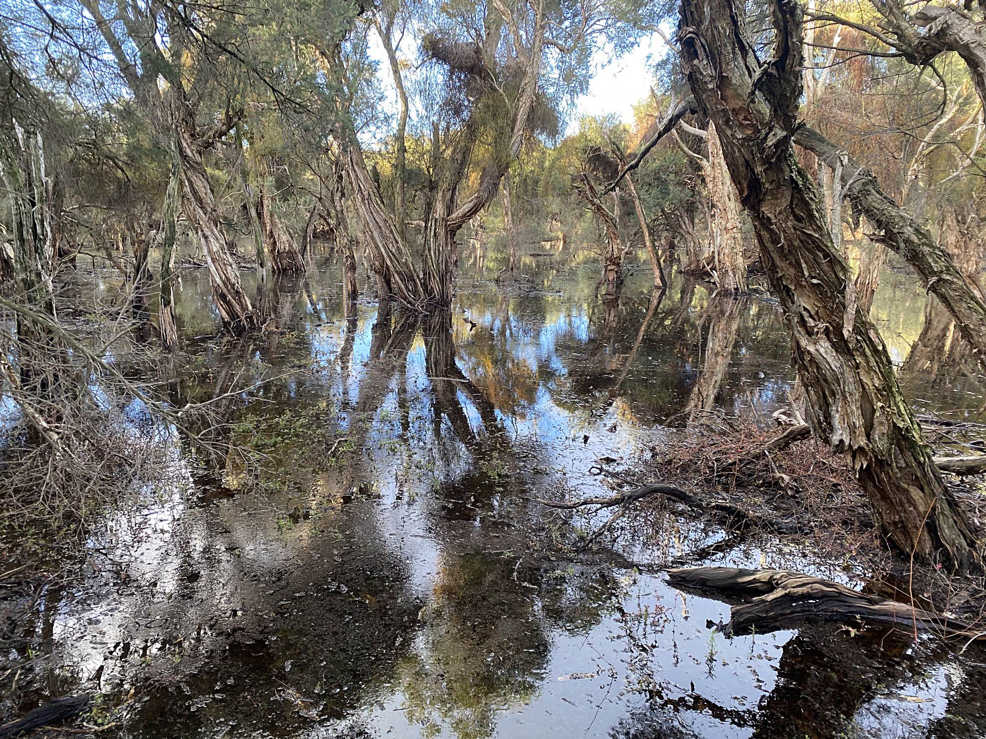
Many people walk their dogs around the Len Howard Conservation Park area. In the summer months there is very little or no fresh water available for dogs to drink in the area. Someone maintains a watering point mainly for kangaroos in the big seasonal paperbark swamp (I wish there as a shorter and generally accepted name for that) from about the end of the year until about May when water starts to become available in the swamp itself. I'm sure that dogs use it too, although it is difficult for small dogs to use because of the high sides of the container.

There is also a tap at the car park near "Nature's Eye".


This section added
2022/05/06

Rubbish

Just as around where I used to live in South Australia there is rubbish scattered carelessly around the Mandurah area. I intend to continue cleaning up this rubbish in my new neighbourhood.

Today I picked up a bag full in the little reserve area at the western junction of Silverton Crescent and Wattleglen Avenue.

It is common for people to dump garden waste in the local parks.

I came across a shocking amount of rubbish in the patch of scrub adjacent to the Riverside Primary School on 2022/05/09, apparently left by someone who was sleeping rough. I made no attempt to pick it up.

As discussed on another page on this site, there needs to be a noun for the type of careless, irresponsible, lazy people who do this sort of thing.


This section added
2022/06/26

Vandalism

 
Vandalised sign
Senseless vandalism exists in Mandurah as it does in most other parts of the world.

Some hundred or so of the plants I put into Crystal Brook Central Park back in SA were pulled up be one or more vandals. Fortunately, to the time of writing, few of the plants that I've put into a small park near my new home have been damaged by vandals.

Dumping rubbish, discussed above, is a form of vandalism.

Valdalism at the train station car park

I noticed on 2022/07/03 that about a half dozen large recently planted trees adjacent to the new multi-story car park had been broken off. There was only one or two that had been left undamaged. By the 5th they had all been removed.

Vandalism of my tree guards

2022/07/07; see the page on my projects in the Erskine area.


This section added
2022/07/29

Weeds

As is the case with most of the public places with which I am familiar there are weeds in Mandurah, adjacent public paths and in parks and gardens. I find the unwillingness of the great majority of the local people to take part in the improvement of their public places puzzling.


Reprimanded for digging out weeds

To my amazement on 2022/08/01 a ranger reprimanded me for digging out dune onion weed from one of the parks in Erskine.
I've written on my efforts to remove some of them on my page titled Fleabane. I've speculated on how people look after their private gardens but don't bother with their shared places, and commented on Whatever happened to civic pride? in relation to the unwillingness of the general public to take part in improving their public spaces. And I've written on contribution on another page.

Self or community?

I suspect that selfishness is a factor in people's unwillingness to look after public parks and gardens, as it probably is in the unwillingness of many to donate blood (only some 3% of Australians donate blood or blood products). On the subject of selfishness, there are many private jetties in the Mandurah area, most have signs on them telling other people to keep off. Surely reasonable use by the public would be unlikely to harm the jetties or inconvenience the owners?


Odd comments
Why would anyone want to remove weeds from parks?

I have made a project of working at improving the parks and paths in my local area. It seems to me only natural that I should want to do this. Yet I get the impression that many people find it hard to understand my actions or motivations. I, in turn, find it very hard to understand their lack of understanding; do they not think that we should care for our public places? Or do they just think, "It's not my job. Let somebody else do it."


Related work

In addition to the onion weed removal that brought about this section, I've also pulled out fleabane and picked up rubbish. Perhaps the people who can't understand my work at controlling onion weed would find this equally inexplicable?
About mid July 2022 I was hoeing out onion weeds adjacent to one of the paved trails in the big seasonal paperbark swamp east of my home when a man stopped and asked: "Why are you doing that?" as if my purpose was unimaginable to him. Was he unusual or would it be so incomprehensible to many that a person would want to remove weeds from a conservation park?

2022/07/24, another man stopped and said: "I've got to ask, why are you doing that?" I said something like "I'm digging out weeds; they have no place in a public park." Several other possible answers came to mind after I had thought about it for a while:

  • Would you dig a weed out of your garden? Why then not out of a public park?
  • Do you not care about weeds in your public places?
  • I dig weeds out of my garden, why should I care less about a public park?
  • If I am unwilling to try to improve our public places, why should anyone else?
  • If no one cares for our parks what will become of them?
  • If you have to ask you will probably not understand my answer.
  • This is a beautiful park which the people of Mandurah are very lucky to have. Removing the most conspicuous, unsightly and invasive weeds can only improve it.
Is caring for our shared environment such an uncommon thing to do? My page on contribution covers the point in depth. My notes on self or all and the rights and needs of future generations are also relevant.


Primewest, Erskine shopping centre: a lost opportunity to reduce greenhouse emissions and increase profitability at the same time?

 
Prime West shopping centre, Erskine, WA
Shaded car park
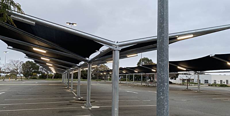
A great opportunity lost.
And a careless waste of electricity.
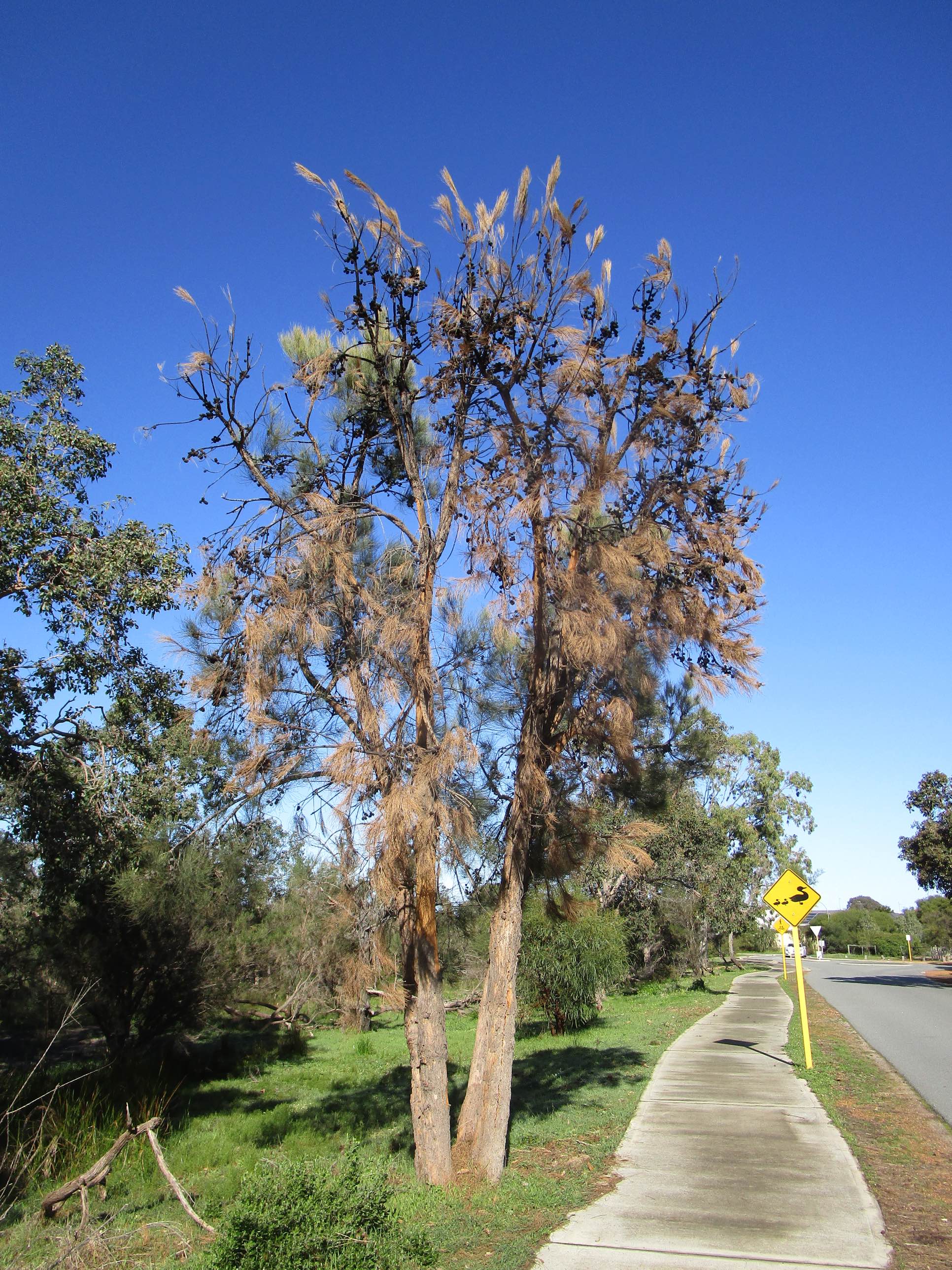
In August 2022 car park shades were installed in the Prime West, Erskine, WA shopping centre car park. The shades were plastic mesh, not solar PV panels, a lost opportunity.

Had solar panel shades been installed rather than simple shade sails most of the power consumption of the shopping centre could have been offset and a huge amount of greenhouse emissions avoided (most of Western Australia's power is generated by coal-fired power stations). I estimated that the area covered by the shade sails was 1,320m2, twice that of the Woolworths, Clare, shades, so had solar PV panels been used rather than shade sails the installed capacity would be around 280kW. Such a solar PV installation would generate about 490 megawatt-hours of electricity each year and that could reduce WA's greenhouse CO2 emissions by something like 400 tonnes each year.

I've written a page on solar PV shade in car parks and other places elsewhere on this site.

In 2022 solar PV panels typically pay for themselves in about five years. In this case where the cost of installing the shade cloth sails would have been avoided, the payback time would be shorter. PV panels also have the advantage of casting denser shade than shade cloth, so the cars beneath the panels would be cooler in summer.

A waste of electricity for needless lighting too

Note in the photo too that the lights beneath the shades are on, as are the two tall floodlights that can be seen in this photo. There were about 40 of each types of lights in the shopping centre car park. So far as I have been able to tell all were left on 24 hours a day. The shopping centre is open only from 8am to 6pm most days (Sundays 10am to 5pm, plus to 9pm on Thursdays) so outdoor lighting would only be necessary Thursday evenings and evenings in winter. On 2022/09/18 I emailed Prime West telling them about the lights being on all the time; I didn't ever receive a response.

A letter to the editor and a result

On 2022/09/30 I wrote a letter to the local newspaper on both the above points. It was published in at least one (Mandurah Coastal Times) a few days later. On 2022/10/12 I noticed that the car park lights were off..

One can hint and push but it is a rare thing to get a definite result such as this one. Having the car park lights on only when needed (if that is what happens in future) will reduce greenhouse gas emissions by something like 30 tonnes each year.

Other shopping centre owners are far more progressive

In Western Australia for example Northam Boulevard (article in The West Australian), belonging to Perdaman Group, 2,211 panels in total, 900 of these shading the carpark, and Dunsborough Centrepoint shopping centre (article in The West Australian).

 
In my home state, SA, there are big solar shaded carpark installations at Vicinity Centres (claimed to be the biggest in Australia at the time of construction, 1,400 panels on the car park alone) and Castle Plaza (430 solar shaded parking spaces).

Also see my page on solar car park shades.


Development? Progress?

Mandurah is a fast growing city in what was, not so long ago, a mostly undisturbed area. It seems that the soil was too poor for it to be attractive for farming and whatever pastoralism there was didn't much impact the more coastal areas.

However, development has come to Mandurah in a big way in the last few decades.

 
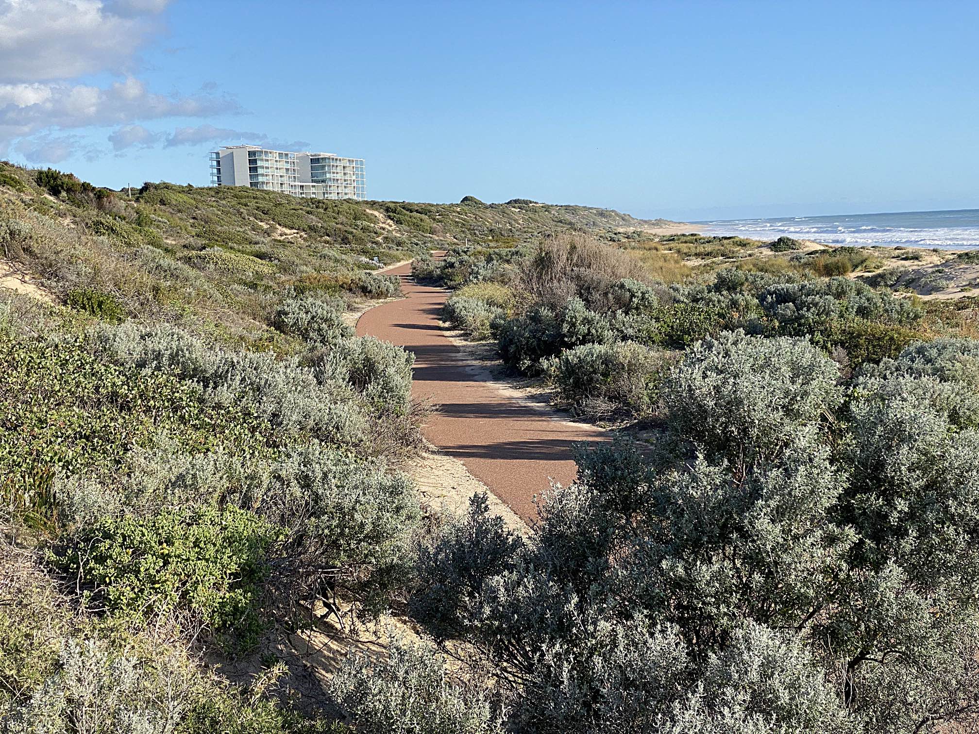
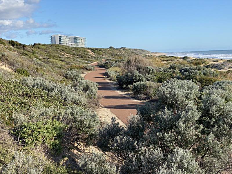
Seaside vegetation in its natural state
I'm sure that there is a story in these three photos, but I can only guess at what it may be.

This first image was recorded just south of the Dawesville Cut. It seems to be largely untouched native heath vegetation, outside of the shared walking/cycling path.

The high-rise buildings are at The Cut Golf Course.
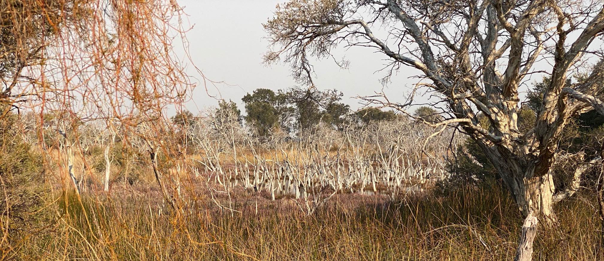
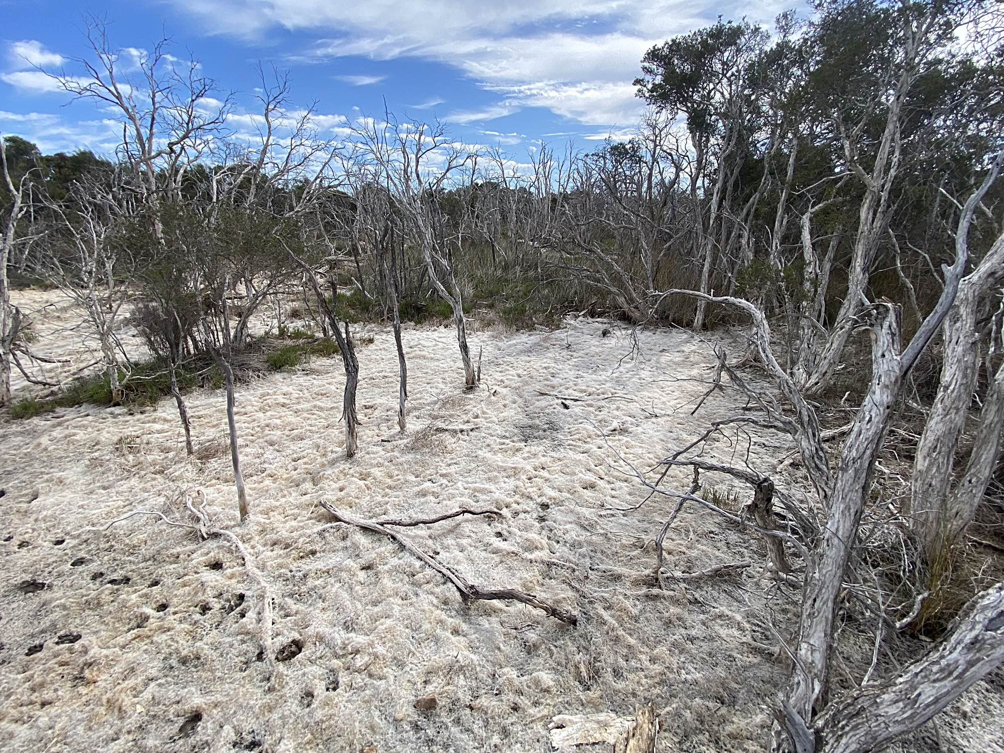
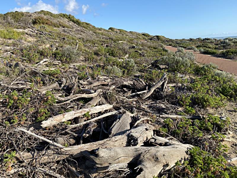
Tree graveyard

 
Tree graveyard
Tree graveyard
I didn't know what to make of this area when I first came across it, several hundred metres further south than the area in the photo above.

It was the third photo (below) that gave a clue to what happened here.

 
These photos were all taken with my iPhone 11 Pro on 2023/08/03.

 
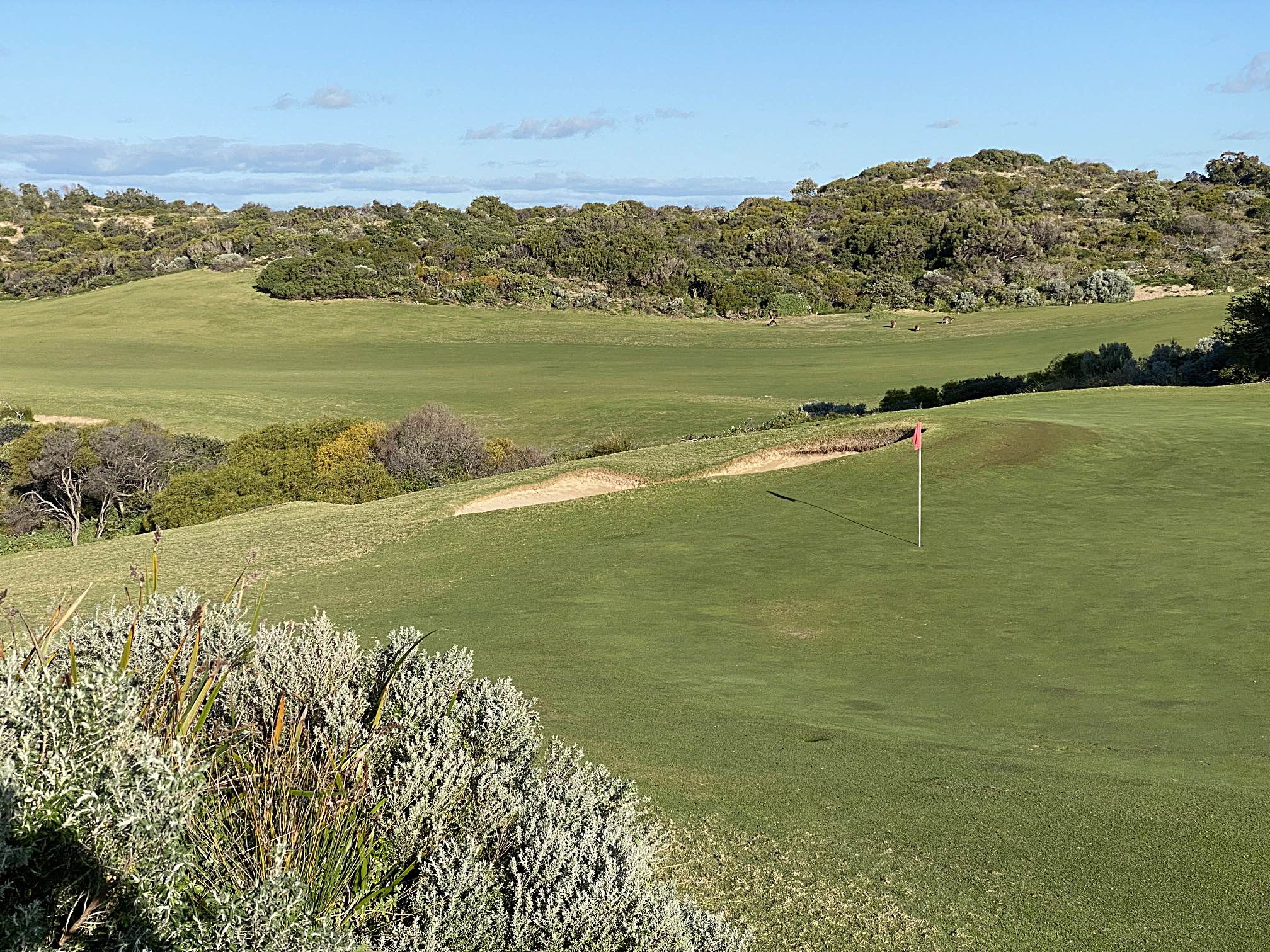
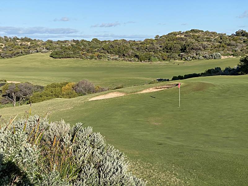
'Developed' golf course
Golf course
This golf course, "The Cut Golf Course", was on the inland (eastern) side of the foreshore dune and the above photo.

I suspect that when the bush was cleared for the golf course the developers were not allowed to burn all the removed vegetation so they carted it over the foreshore dune and dumped in the 'tree graveyard'.

Google Earth gives the impression that the 'tree graveyard' extends for the kilometre or more of the golf course.

We can only hope that the heath will eventually recover where it has been so greatly disturbed by the machinery and the dumping of the ripped out bush.

Note the kangaroos in the distance on the golf course.


Why walk past, why not fix it?

 
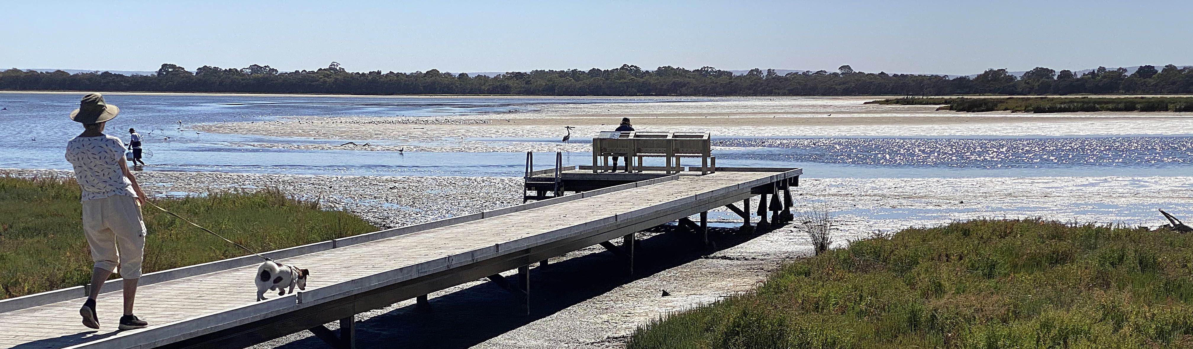
A fence partly obstructing a path
Fence encroaching on path
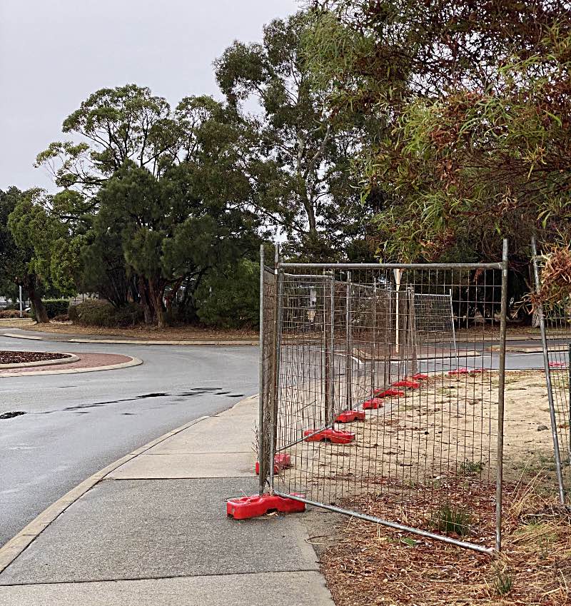
Thousands of people (including me) have walked past this fence in the more than a year that it has been in place and done nothing.
Many people use that path every day. I’ve used that path many times. The fence was unnecessarily partly obstructing the path adjacent to a busy roundabout and shopping centre for at least a year. It made it harder for cyclists, pedestrians, people with prams, mobility problems, etcetera to pass each other; and there was the danger of a vehicle-pedestrian accident.

Why were we all so unwilling to do something about it? I suspect it didn’t occur to most of us that we could do something about it.

Why did the council allow the fence to encroach on the path when there was no need for it? Why did I put up with it for so long before I did something about it?

I've written more on this subject on another page on this site.


This section added
2023/11/17

A fire in a reserve near my home

I intend to observe the recovery of the bush in this area over the next few years.
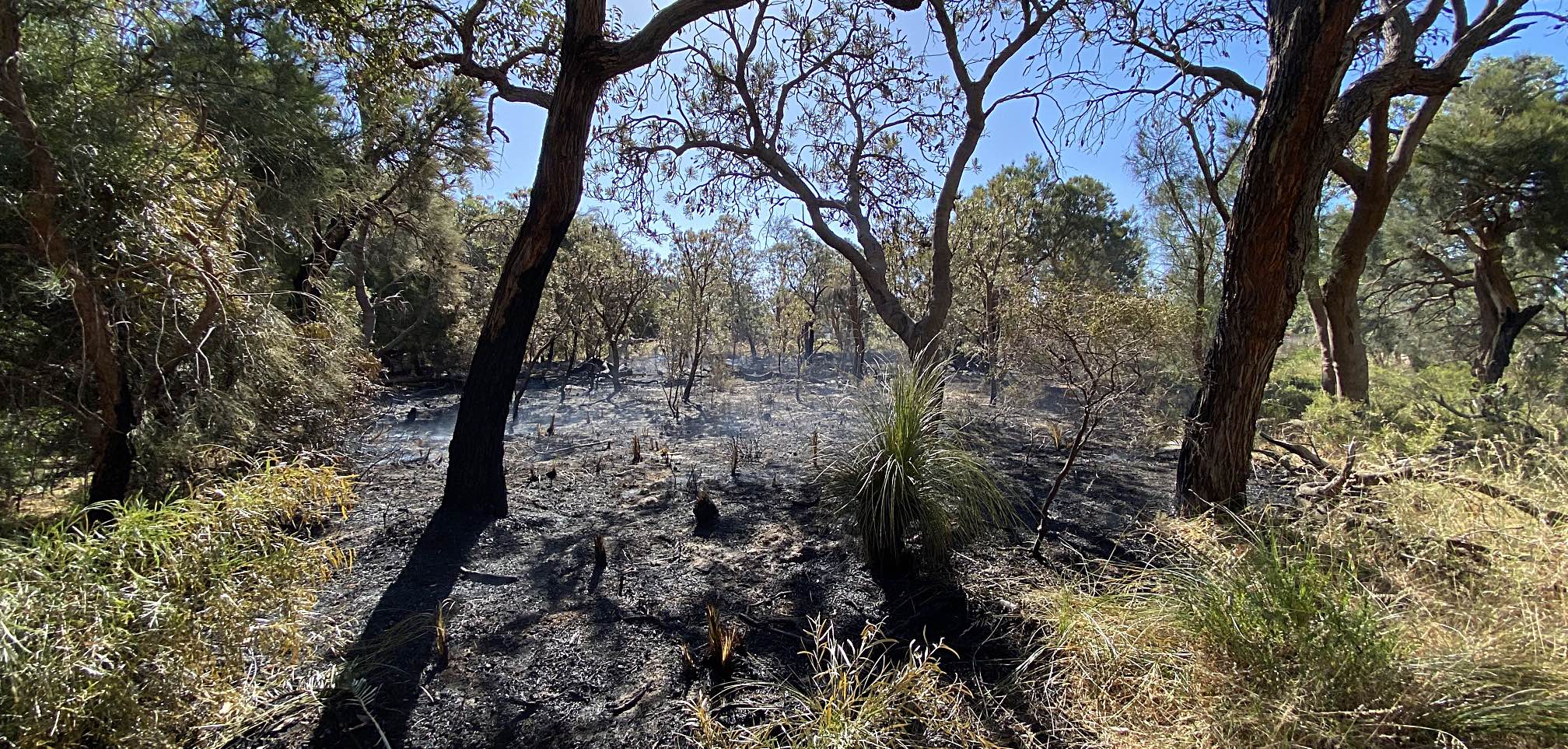
 
The burned area
Burned reserve in Erskine
The day of the first fire, 2023/11/15
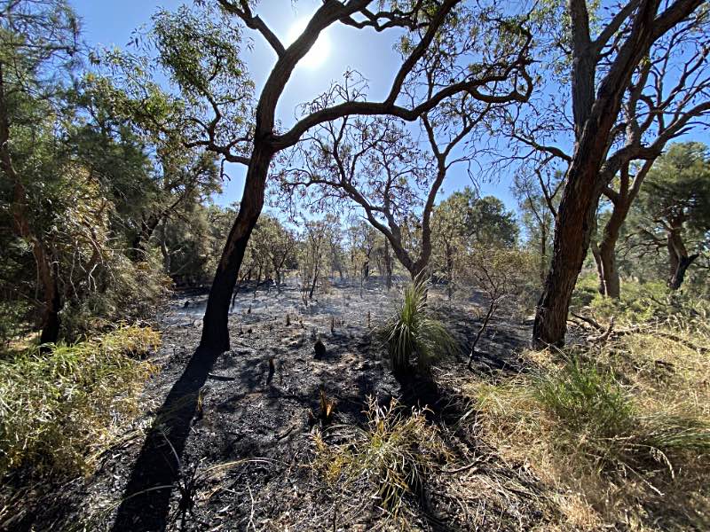
There was a fire in a small reserve near my home in Erskine. I was informed by a firefighter who was there later in the day extinguishing smouldering remnants that it was not a controlled burn. It seems likely to have been lit by a fire bug.

I have adopted some responsibility for removing invasive weeds in this reserve as recorded on another page on this site. I've called it the W/S (Wattleglen/Silverton) reserve for the adjacent roads and because it seems to have no formal name. About a quarter of the little reserve was burned.

Photo iPhone 11 Pro, wide angle lens, 1.54mm fl, 2023/11/15, the day of the fire

Update

There was another fire in the same little patch of scrub on 2023/11/18. I noticed three burned patches in a chair that I had placed in the reserve a few months earlier. The chair was about 30 metres on the upwind side of the fire, so it would seem very unlikely that the burned patches were caused by sparks from the fire. I estimated that between the two fires two thirds of the reserve has been burned. I've heard that it was a 12 year-old boy who lit both fires and that the police had been informed.

 
This section added
2024/05/04

Regrowth in the burned area

 
After a long, hot, dry summer
Regrowth
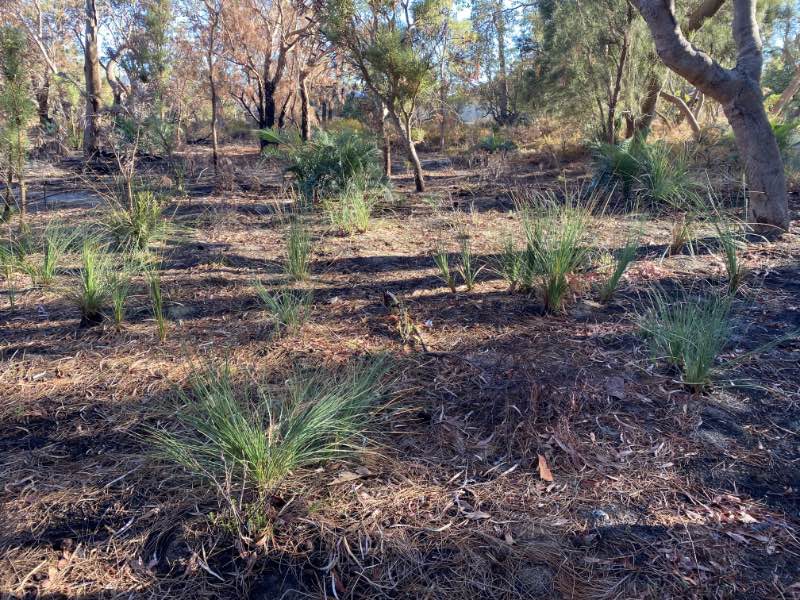
Photo iPhone 11 Pro, 2024/05/04
This photo was taken a couple of days after the first significant rain of 2024 following the very dry five months from the beginning of December 2023 to the beginning of May 2024. There was 4.4mm over the five months, and 30mm in the first few days of May.

After the fires in 2023/11/15 and 18th there was ten millimetres of rain in late November then 4.4mm in the following five months.

Remarkably, in spite of the long, hot, dry summer (one of the hottest and driest on record), there was a lot of regrowth in the little reserve. After having all been burned right down to ground level, as can be seen in the photo taken the day of the fire, some of the small yaccas had grown up to 90cm high.

The top 10cm or so of leaves on many had died and gone brown, perhaps this was due to stress from the lack of moisture.


A period of exceptionally low tides

 
Lake Goegrup
Low tide Lake Goegrup
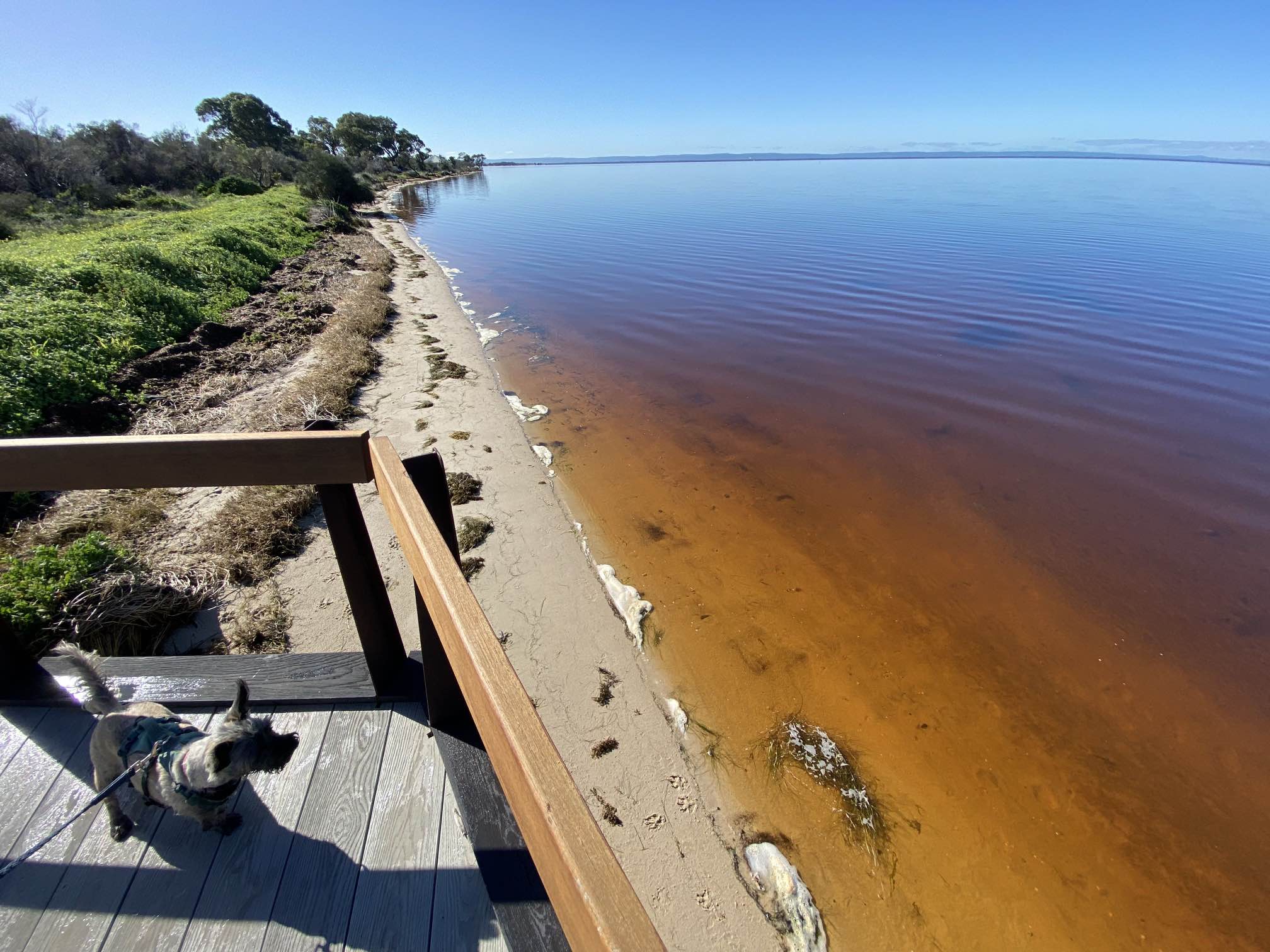
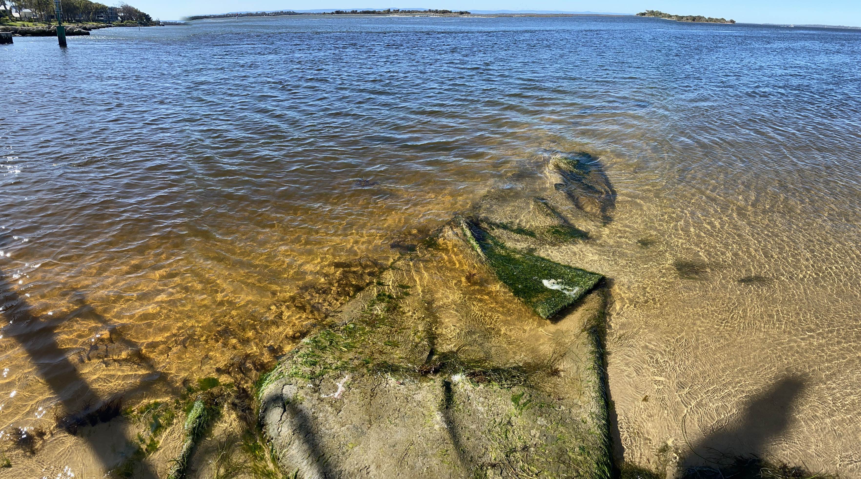
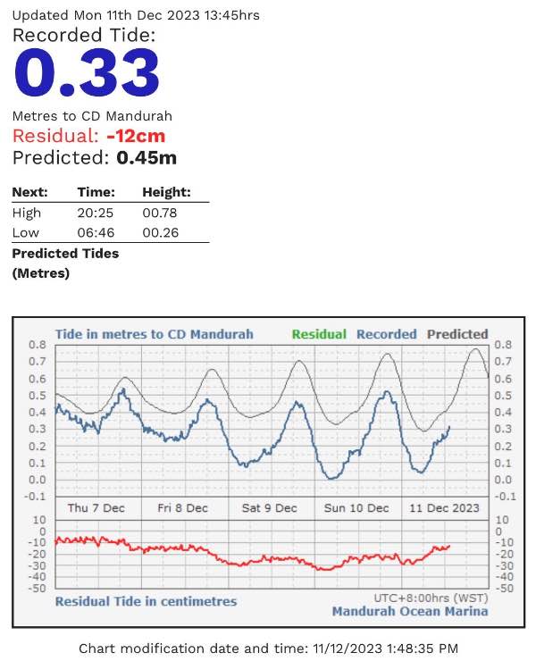
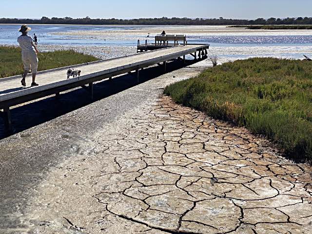
There was an exceptionally low tide in the few days around 10th December 2023.

The local newspaper reported that two young dolphins were stranded in this lake, twice.

It seems that the very low water levels were due to strong and persistent offshore winds.

Photo iPhone 11 Pro, telephoto lens, fl 6.0mm; 2023/12/11, 08.52

 
Tide record
A record of the tides; the black line on the graph shows what the calculated tide was expected to be, the blue line shows the actual recorded tide level.

The red line on the lower graph shows the difference between the two. It reached a maximum of about 0.33m about 3am on the morning of Sunday 10th.

It seems that the tide recording station in near the mouth of the Peel estuary, quite a way from Lake Goegrup.


Climate change

CSIRO: Australia's changing climate; a quote...
"The drying trend is particularly strong between May to July over southwest Western Australia, with rainfall since 1970 around 20 per cent less than the average from 1900 to 1969. Since 1999, this reduction has increased to around 26 per cent."
(I have expanded on this on another page on this site.)

Do the people of Mandurah respond to this obvious and very important local change in the climate by changing their lifestyle in any way? It would seem not. Just one example: I've seen that at least on the one occasion that I made an observation and simple calculation, only about 1% of the local people use busses rather than driving.


Miscellaneous observations

Catamaran with side-by-side masts

side-by-side masts

This is something I’ve never seen before, even in photos or drawings. The two masts are side-by-side, one on each of the catamaran’s hulls. The multiple masts I’ve seen previously have always been in line. I suppose this is more experimental than anything else; if a side-by-side mast system did turn out to be viable a lot of experimentation would need to be done to work out the best way of doing it.

It was anchored at the Mandurah foreshore on 2023/08/13. I didn't see any name on the hull, but 'Ozone' was on one of the booms.

A quick Internet search produced only one page that dealt with a side-by-side mast rig: Some reasons why I have chosen a side by side rig. The page is dated 2014 and pictures show a gaff rigged model; the full size boat may not have been built.


Diagonal solar panels

 
Diagonal solar panels
Photo iPhone 11 Pro, 2023/07/20
These are the first solar panels that I can recall seeing that were installed diagonally. They were on the western side of the Big Seasonal Paperbark Swamp in Erskine and adjacent to the Bridgewater Lifestyle Village.

The reason for placing these diagonally is obvious. Given the shape of the roof sections this was the best way that ten panels would fit. Why is placing them diagonally so rare? I don't know.

They reminded me of the triangular solar panels that I saw in Japan where space was at a premium and it was important to use as much roof space as possible for a solar power installation.


Related pages

On this site...

Bowman Park, Crystal Brook, South Australia

Cleaning up roadside rubbish

Climate change, the world's great threat and challenge

Contributing to our communities
  Blood donation

Crystal Brook's Central Park, SA

Destruction of roadside vegetation by a body that should be protecting it

Gleeson wetlands, Clare, South Australia

The remainder of my life

Why I support the local wind farm

Offshore wind farms in Australia, why the world needs them and how to find reliable information on them.

Specific to WA

A photographic record of a visit to the South of WA

Fleabane, my efforts to remove it in and near the Len Howard Reserve, and similar local environmental improvement projects

Images of WA, from a visitor

Images of WA, from a new resident

Mandurah volunteer workers; keeping in touch

Bicycle rides around Mandurah

A teal politician for Canning; let's get a more responsible parliament

Mandurah, a note on conspicuous consumption


Names and abbreviations I've used

Big seasonal paperbark swamp, BSPS
The large reserve area west of Bridgewater Lifestyle Village and south of Oakleigh Drive.

Reserve at the western junction of Wattleglen and Silverton roads, W/S Reserve.
This happens to be close to our house.

Car park on the lagoon in Len Howard Conservation Park, LHCP
The car parking area near the western end of the Len Howard Conservation Park.


Index

On this page...

Abbreviations and names I've used
Bandicoots
Bats
Big Seasonal Paperbark Swamp, in the Len Howard Conservation Park
  Observations on water in BSPS, 2022
  Observations on water in BSPS, 2023
Catamaran with side-by-side masts
Climate change
Dead trees in the Peel estuary
  Salinity record
Development? Progress?
Diagonal solar panels
Dog water
Estuary
  Water colour change
Fire in a reserve near my home
Kangaroos
  Injured kangaroo
Len Howard Conservation Park
  Lightning charred tree in Len Howard CP
  Section of path needing attention
  White algae
Letter to the editor and a result
Lizards
Miscellaneous observations
Names and abbreviations I've used
Ocean beach at Mandurah
Path widening in the Len Howard Conservation Park
Plants
  Sundews
Primewest, Erskine shopping centre, a lost opportunity
A period of exceptionally low tides
Pond and bog on trail
Rainfall seasonality
Regrowth in the burned area
Related pages
Rubbish
Salinity record
Swamp, seasonal, in the Len Howard Conservation Park
Seasonality of rainfall
Section trail that needs attention
Self or community?
Side-by-side masts
Solar panels, diagonal
Sundews
Swamp, how it came to be a reserve
Tidal Movement
  A period of exceptionally low tides
Tree graveyard
Lack of undergrowth in the BSPS
Vandalism
Very dry period
Water colour change
Weeds
  Weeds in and near the LHCP
  Weeds; Odd comments
White algae in Len Howard Conservation Park
Why walk past, why not fix it?
Why would anyone want to remove weeds from parks?
Widening of the path in the Len Howard Conservation Park
Wildlife